MyTopo
Whiteface Minnesota US Topo Map
Couldn't load pickup availability
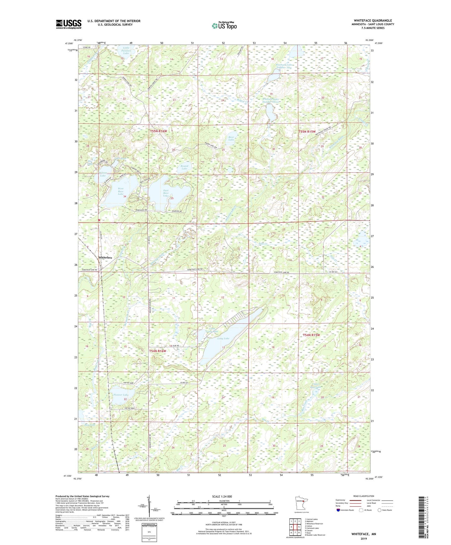
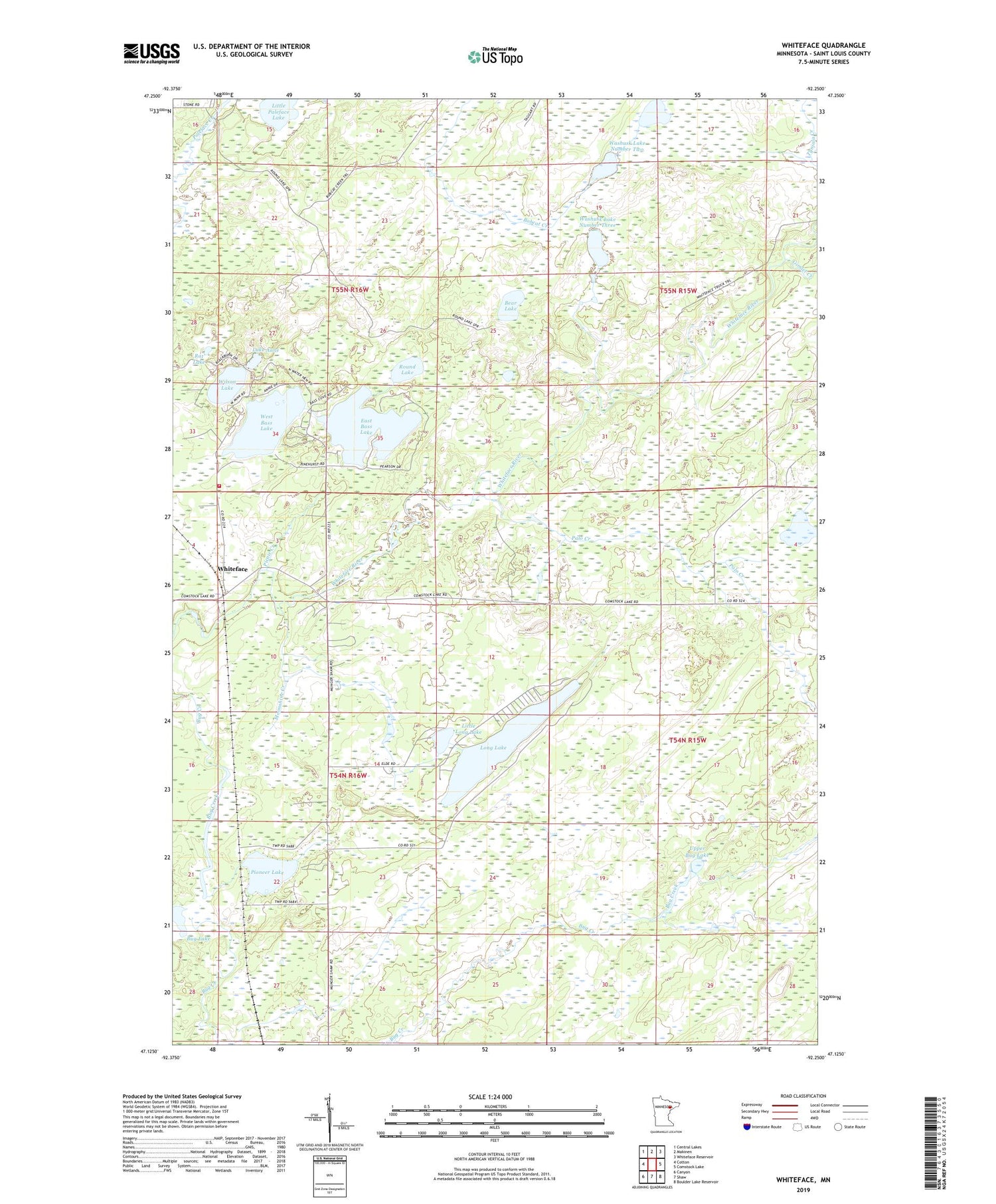
2019 topographic map quadrangle Whiteface in the state of Minnesota. Scale: 1:24000. Based on the newly updated USGS 7.5' US Topo map series, this map is in the following counties: St. Louis. The map contains contour data, water features, and other items you are used to seeing on USGS maps, but also has updated roads and other features. This is the next generation of topographic maps. Printed on high-quality waterproof paper with UV fade-resistant inks.
Quads adjacent to this one:
West: Cotton
Northwest: Central Lakes
North: Makinen
Northeast: Whiteface Reservoir
East: Comstock Lake
Southeast: Boulder Lake Reservoir
South: Shaw
Southwest: Canyon
Contains the following named places: Bear Lake, Bug Lake, East Bass Lake, Ellsburg Volunteer Fire Department, Gimlet Creek, Hendrickson Lake, Lake Anne, Little Long Lake, Little Paleface Lake, Long Lake, Moonshine Creek, Palo Creek, Picnic Creek, Pioneer Lake, Rat Lake, Round Lake, Upper Bug Lake, Washusk Lake Number One, Washusk Lake Number Three, Washusk Lake Number Two, West Bass Lake, Whiteface, Wilson Lake, ZIP Code: 55724