MyTopo
Cotton Minnesota US Topo Map
Couldn't load pickup availability
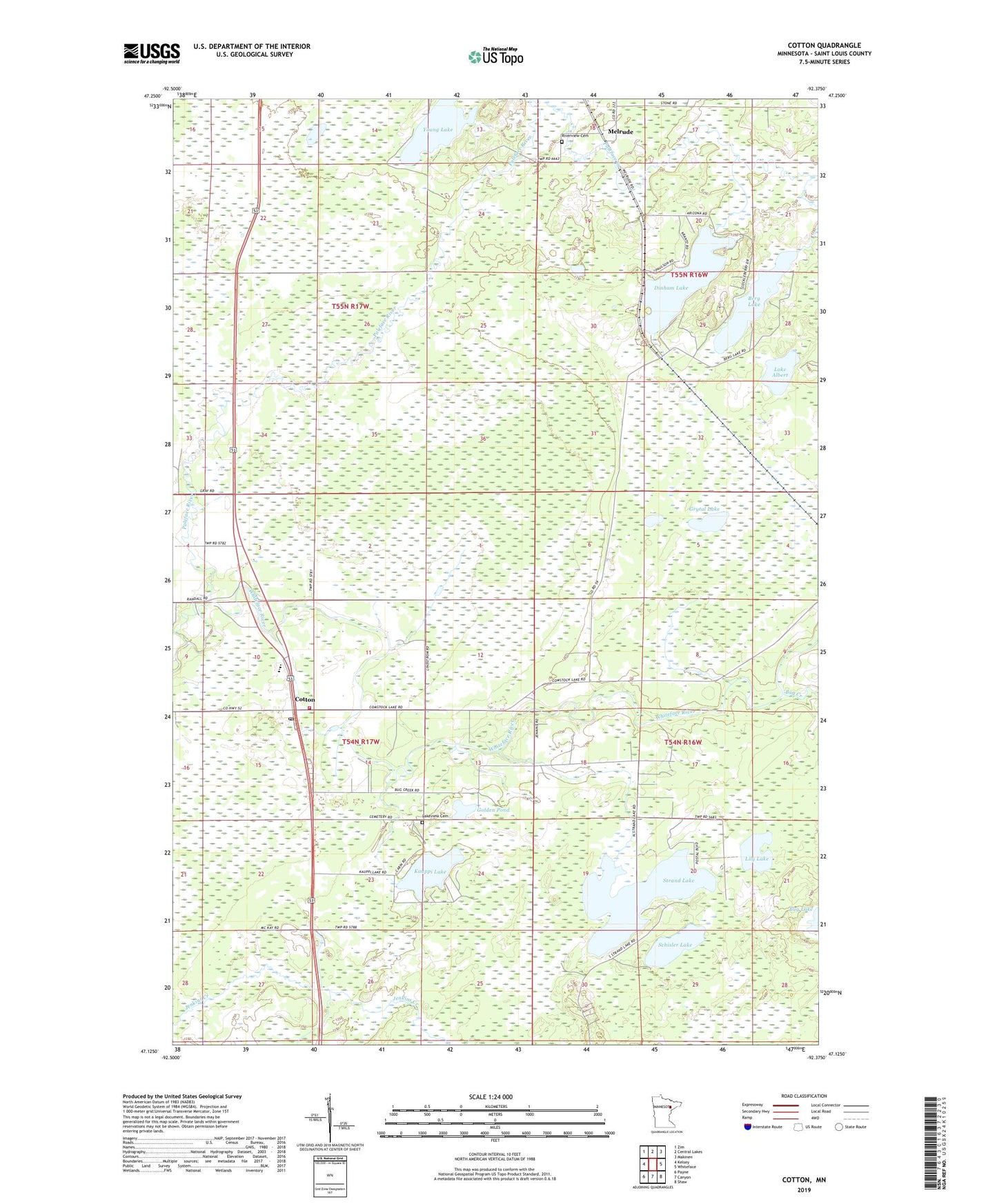
2022 topographic map quadrangle Cotton in the state of Minnesota. Scale: 1:24000. Based on the newly updated USGS 7.5' US Topo map series, this map is in the following counties: St. Louis. The map contains contour data, water features, and other items you are used to seeing on USGS maps, but also has updated roads and other features. This is the next generation of topographic maps. Printed on high-quality waterproof paper with UV fade-resistant inks.
Quads adjacent to this one:
West: Kelsey
Northwest: Zim
North: Central Lakes
Northeast: Makinen
East: Whiteface
Southeast: Shaw
South: Canyon
Southwest: Payne
This map covers the same area as the classic USGS quad with code o47092b4.
Contains the following named places: Berg Lake, Bug Creek, Central Lakes, Cotton, Cotton Clinic, Cotton Post Office, Cotton Volunteer Fire Department, County School Number One Hundred, Dinham Lake, Ellsburg Volunteer Fire Department - Melrude Town Hall Fire Station, Golden Pond, Grytal Lake, Kauppi Lake, Lake Albert, Lakeview Cemetery, Lily Lake, Melrude, Melrude Post Office, Melrude Station, Melrude Town Hall, Paleface River, Riverview Cemetery, Schisler Lake, Stephen Slimak Wildlife Pond Dam, Strand Lake, Township of Cotton, Township of Ellsburg, Young Lake