MyTopo
Wirt Minnesota US Topo Map
Couldn't load pickup availability
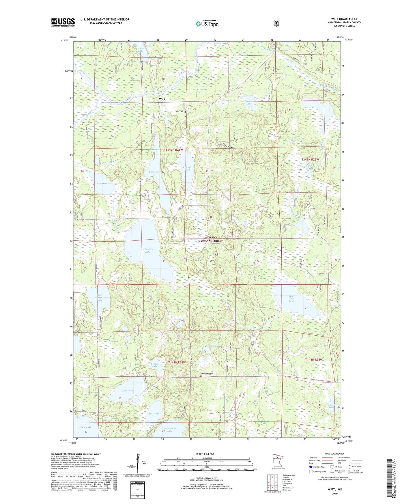
2019 topographic map quadrangle Wirt in the state of Minnesota. Scale: 1:24000. Based on the newly updated USGS 7.5' US Topo map series, this map is in the following counties: Itasca. The map contains contour data, water features, and other items you are used to seeing on USGS maps, but also has updated roads and other features. This is the next generation of topographic maps. Printed on high-quality waterproof paper with UV fade-resistant inks.
Quads adjacent to this one:
West: Dora Lake
Northwest: Coddington Lake
North: Pomroy
Northeast: Wildwood SE
East: Spring Lake
Southeast: Jessie Lake
South: Bowstring Lake
Southwest: Max
Contains the following named places: Ames Lake, Arrowhead Lake Creek, Bass Lake, Bass Lake Lookout Tower, Bass Lake Post Office, Beaver Lake, Beaver Lodge Dam, Beaver Lodge Impoundment, Beaver Lodge Reservoir, Bug Lake, Cedar Lake, Cole Lake, Dogfish Lake, Fletcher Creek Dam, Fletcher Creek Impoundment, Four Town Lake, Goose Lake, Hinken Creek, Holland Lake, Holland Lake Dam, Holland Lake Impoundment, Killdeer Lake, Lake Helen, Little Whitefish Lake, Sand Lake Cemetery, Seaman Lake, Spur Lake, Spur Lake Dam, Stone Axe Lake, Township of Sand Lake, Township of Wirt, Whitefish Lake, Wirst, Wirst Post Office, Wirt, Wirt Cemetery, ZIP Code: 56680