MyTopo
Coddington Lake Minnesota US Topo Map
Couldn't load pickup availability
Also explore the Coddington Lake Forest Service Topo of this same quad for updated USFS data
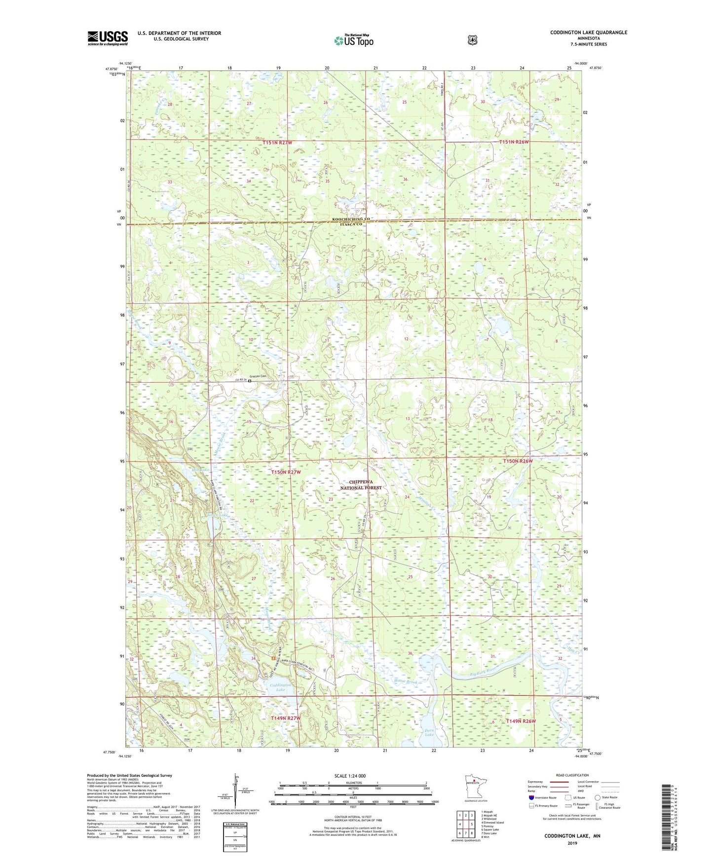
2022 topographic map quadrangle Coddington Lake in the state of Minnesota. Scale: 1:24000. Based on the newly updated USGS 7.5' US Topo map series, this map is in the following counties: Itasca, Koochiching. The map contains contour data, water features, and other items you are used to seeing on USGS maps, but also has updated roads and other features. This is the next generation of topographic maps. Printed on high-quality waterproof paper with UV fade-resistant inks.
Quads adjacent to this one:
West: Elmwood Island
Northwest: Mizpah
North: Mizpah NE
Northeast: Wildwood
East: Pomroy
Southeast: Wirt
South: Dora Lake
Southwest: Squaw Lake
This map covers the same area as the classic USGS quad with code o47094g1.
Contains the following named places: Calvary Covenant Church, Coddington Lake, Dishpan Lake, Dishpan Lake Dam, Dishpan Wildlife Management Area Impoundment Number 2 Dam, Glove Lake, Grattan Cemetery, Grattan Post Office, Hay Creek, Lost '40' Trail, Mitt Lake, Moose Brook, Township of Grattan, Wildlife Marsh, Windigo Creek