
MyTopo
Zim Minnesota US Topo Map
Couldn't load pickup availability
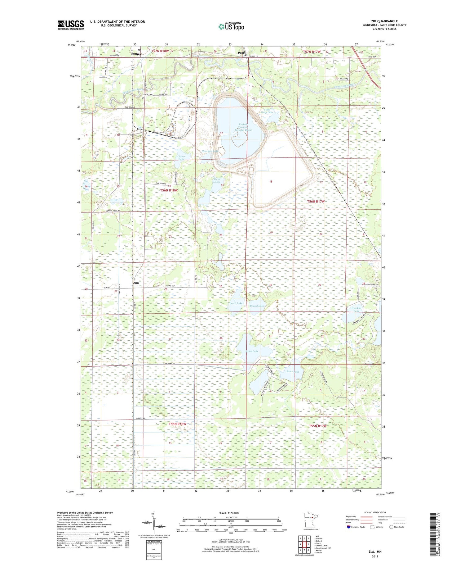
2019 topographic map quadrangle Zim in the state of Minnesota. Scale: 1:24000. Based on the newly updated USGS 7.5' US Topo map series, this map is in the following counties: St. Louis. The map contains contour data, water features, and other items you are used to seeing on USGS maps, but also has updated roads and other features. This is the next generation of topographic maps. Printed on high-quality waterproof paper with UV fade-resistant inks.
Quads adjacent to this one:
West: Casco
Northwest: Kirk
North: Eveleth
Northeast: Gilbert
East: Central Lakes
Southeast: Cotton
South: Kelsey
Southwest: Meadowlands NW
Contains the following named places: Clover Lake, Elbow Creek, Eveleth Taconite Tailings Basin, Eveleth Taconite Tailings Dam, Fens, Forbes, Forbes Cemetery, Forbes Post Office, Forbes Station, Hammer Lake, Hiekkila Lake, Lion Springs Wayside Park, Little Tony Lake, Long Lake Creek, Peary, Perch Lake, Round Lake, Saint Louis River Dam, Stone Lake, Township of McDavitt, Twin Lakes, Zim, Zim Post Office, Zim Station


