MyTopo
Gilbert Minnesota US Topo Map
Couldn't load pickup availability
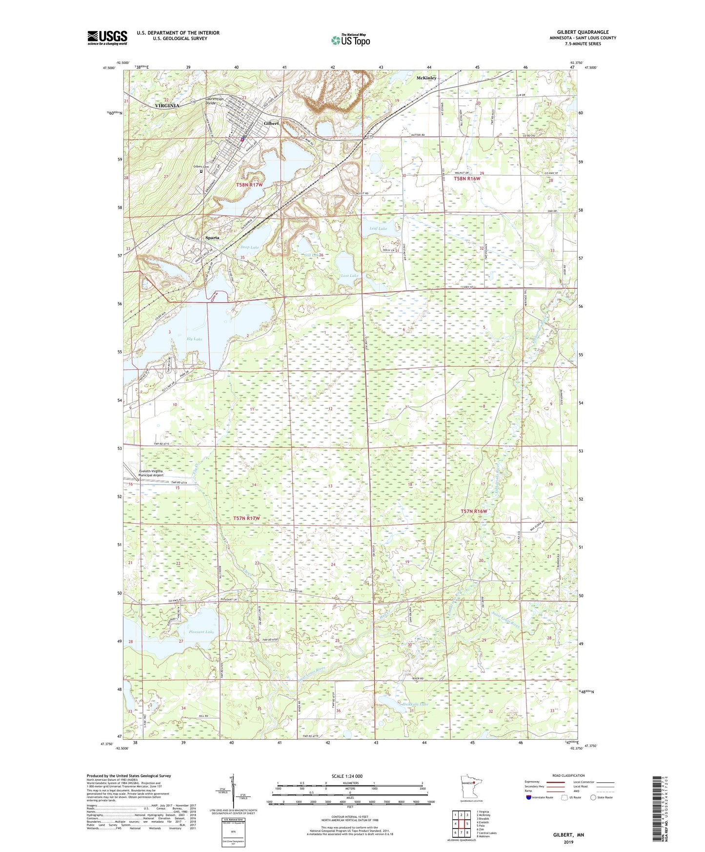
2022 topographic map quadrangle Gilbert in the state of Minnesota. Scale: 1:24000. Based on the newly updated USGS 7.5' US Topo map series, this map is in the following counties: St. Louis. The map contains contour data, water features, and other items you are used to seeing on USGS maps, but also has updated roads and other features. This is the next generation of topographic maps. Printed on high-quality waterproof paper with UV fade-resistant inks.
Quads adjacent to this one:
West: Eveleth
Northwest: Virginia
North: McKinley
Northeast: Biwabik
East: Palo
Southeast: Makinen
South: Central Lakes
Southwest: Zim
This map covers the same area as the classic USGS quad with code o47092d4.
Contains the following named places: City of Gilbert, Deep Lake, Ely Creek, Ely Lake, Ely Lake Dam, Embarrass River, Esquagama Lake, Esquagama Lake Dam, Eveleth Scout Camp, Evelth Junior High School, Fayal Township State Game Refuge, Genoa Mine, Gilbert, Gilbert Cemetery, Gilbert Community Church, Gilbert Fire Department, Gilbert Mine, Gilbert Police Station, Gilbert Post Office, Gilbert Public Library, Gilbert Station, Gill Lake, Hay Creek, Heikkala Lake, Heritage Trail Bible Church, Leaf Lake, Lost Lake, Old Apostolic Lutheran Church, Pleasant Lake, Saint Josephs Church, Schley Mine, Sky Harbor Seaplane Base, Sparta, Sparta Post Office, Sparta Station, Sparta-Matta Mine, Township of Fayal, ZIP Code: 55741