MyTopo
Amory SW Mississippi US Topo Map
Couldn't load pickup availability
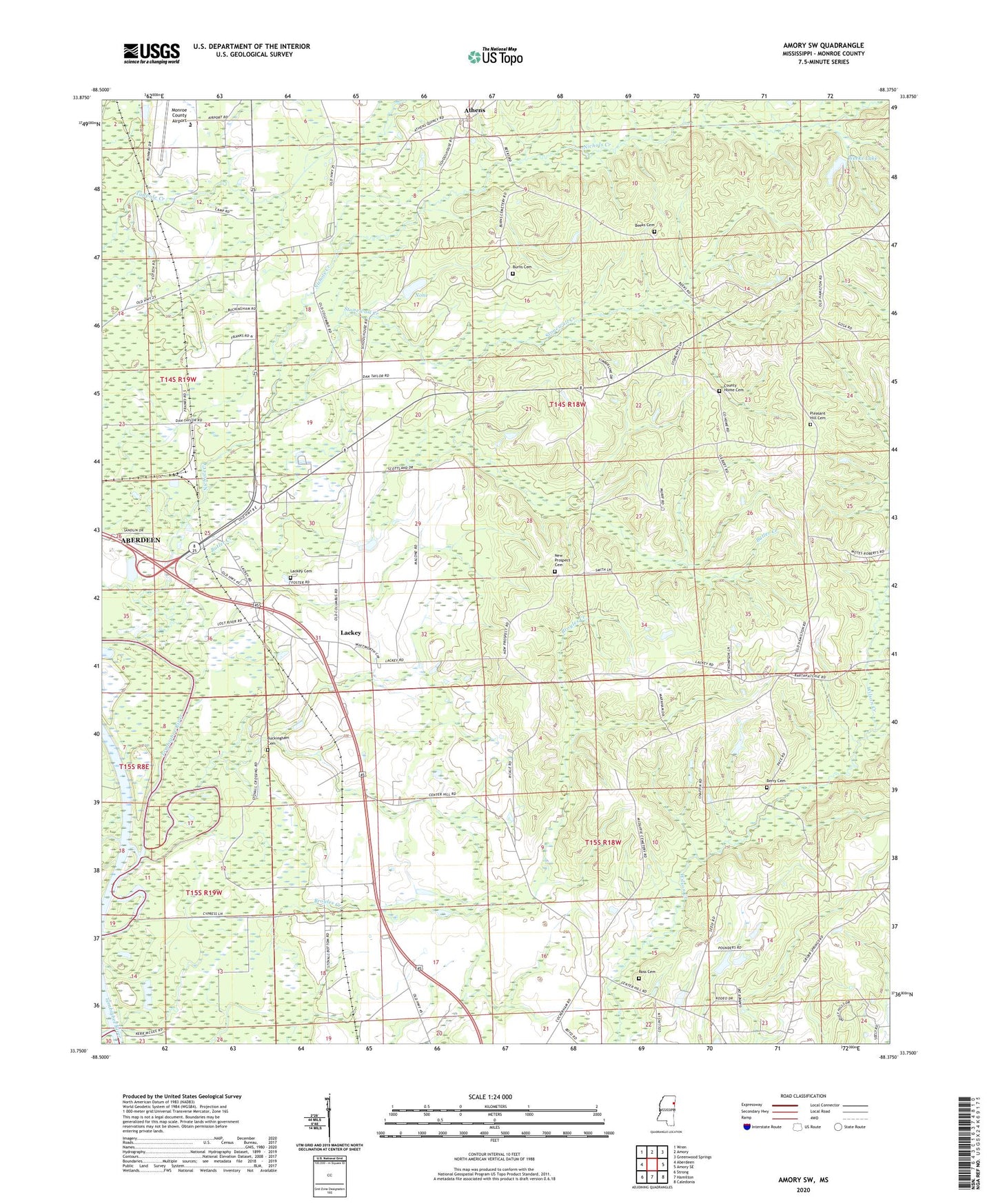
2024 topographic map quadrangle Amory SW in the state of Mississippi. Scale: 1:24000. Based on the newly updated USGS 7.5' US Topo map series, this map is in the following counties: Monroe. The map contains contour data, water features, and other items you are used to seeing on USGS maps, but also has updated roads and other features. This is the next generation of topographic maps. Printed on high-quality waterproof paper with UV fade-resistant inks.
Quads adjacent to this one:
West: Aberdeen
Northwest: Wren
North: Amory
Northeast: Greenwood Springs
East: Amory SE
Southeast: Caledonia
South: Hamilton
Southwest: Strong
This map covers the same area as the classic USGS quad with code o33088g4.
Contains the following named places: A L House Catfish Farm Dam, Ashland, Athens, Athens Baptist Church, Athens Independent Methodist Church, Beeks Cemetery, Berry Cemetery, Broyles Creek, Buckingham Cemetery, Burns Cemetery, Butler Creek, Church of God, County Home Cemetery, Fig Hill Church, Friendship United Methodist Church, Hamilton Baptist Church, Hamilton Church of God, James Creek, Lackey, Lackey Cemetery, Lackeys Ferry, Monroe County Airport, Monroe County Home, New Prospect Cemetery, New Prospect Church, Nichols Creek, None, Paine Memorial United Methodist Church, Pleasant Hill Cemetery, Pleasant Hill Methodist Church, Robert Williams Pond Dam, Ross Cemetery, Ross Mill, Stonewall Creek, Supervisor District 3, Vassar, Weeks Lake, Weeks Lake Dam, Wesley, West Chapel Church of Christ, Westville