MyTopo
Auburn Mississippi US Topo Map
Couldn't load pickup availability
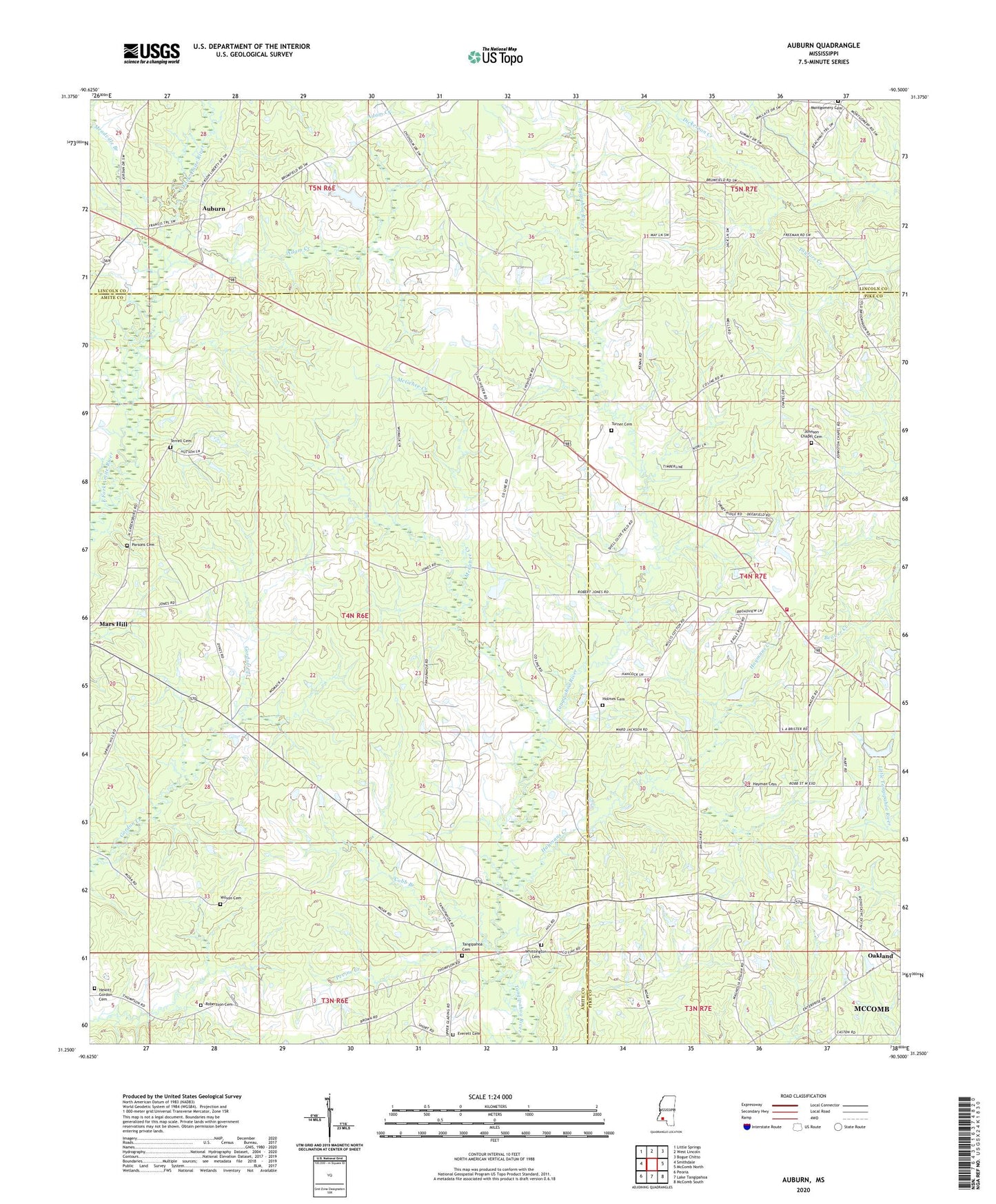
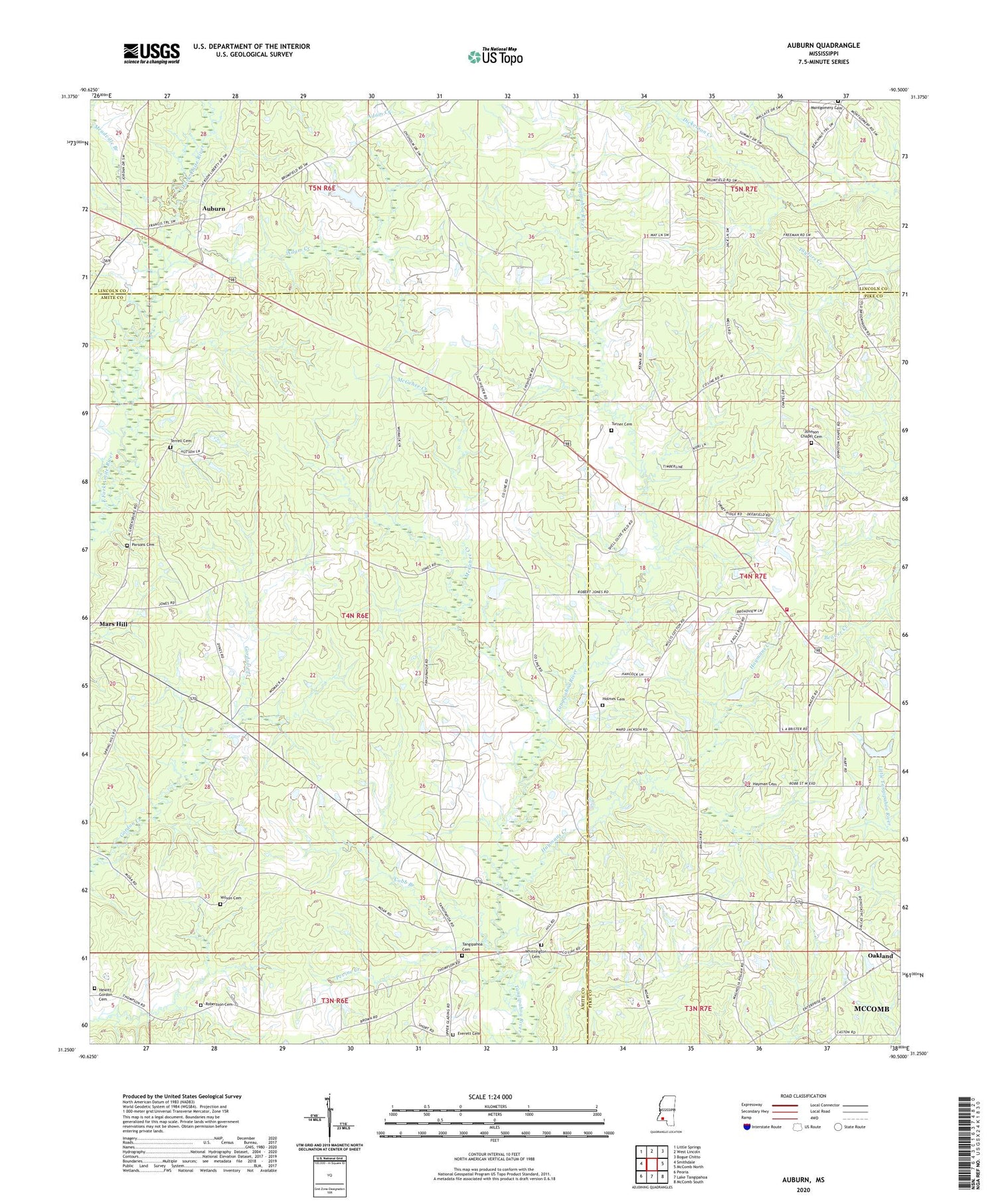
2024 topographic map quadrangle Auburn in the state of Mississippi. Scale: 1:24000. Based on the newly updated USGS 7.5' US Topo map series, this map is in the following counties: Amite, Pike, Lincoln. The map contains contour data, water features, and other items you are used to seeing on USGS maps, but also has updated roads and other features. This is the next generation of topographic maps. Printed on high-quality waterproof paper with UV fade-resistant inks.
Quads adjacent to this one:
West: Smithdale
Northwest: Little Springs
North: West Lincoln
Northeast: Bogue Chitto
East: McComb North
Southeast: McComb South
South: Lake Tangipahoa
Southwest: Peoria
This map covers the same area as the classic USGS quad with code o31090c5.
Contains the following named places: Adam Creek, Adams Church, Auburn, Chisholm Mission, Cobb Branch, Everett Cemetery, Fairfield Post Office, Garner Cemetery, Hayman Cemetery, Haymans Creek, Hewitt Gordon Cemetery, Holmes Cemetery, Huett Store, Johnson Chapel Cemetery, Johnston Chapel, Mars Hill Baptist Church, McGehee Creek, Meadville Branch, Montgomery Church, Mount Canaan Church, Oakland, Parsons Cemetery, Pevine Creek, Pine Grove Church, Pine Grove School, Pine Hill School, Pisgah Church, Pleasant Grove Church, Robertson Cemetery, Smithdale Field, Smithdale Oil Field, Tangipahoa, Tangipahoa Baptist Church, Tangipahoa Cemetery, Tangipahoa Church, Terrell Cemetery, Turner Cemetery, Whittington Cemetery, Wilson Cemetery