MyTopo
Peoria Mississippi US Topo Map
Couldn't load pickup availability
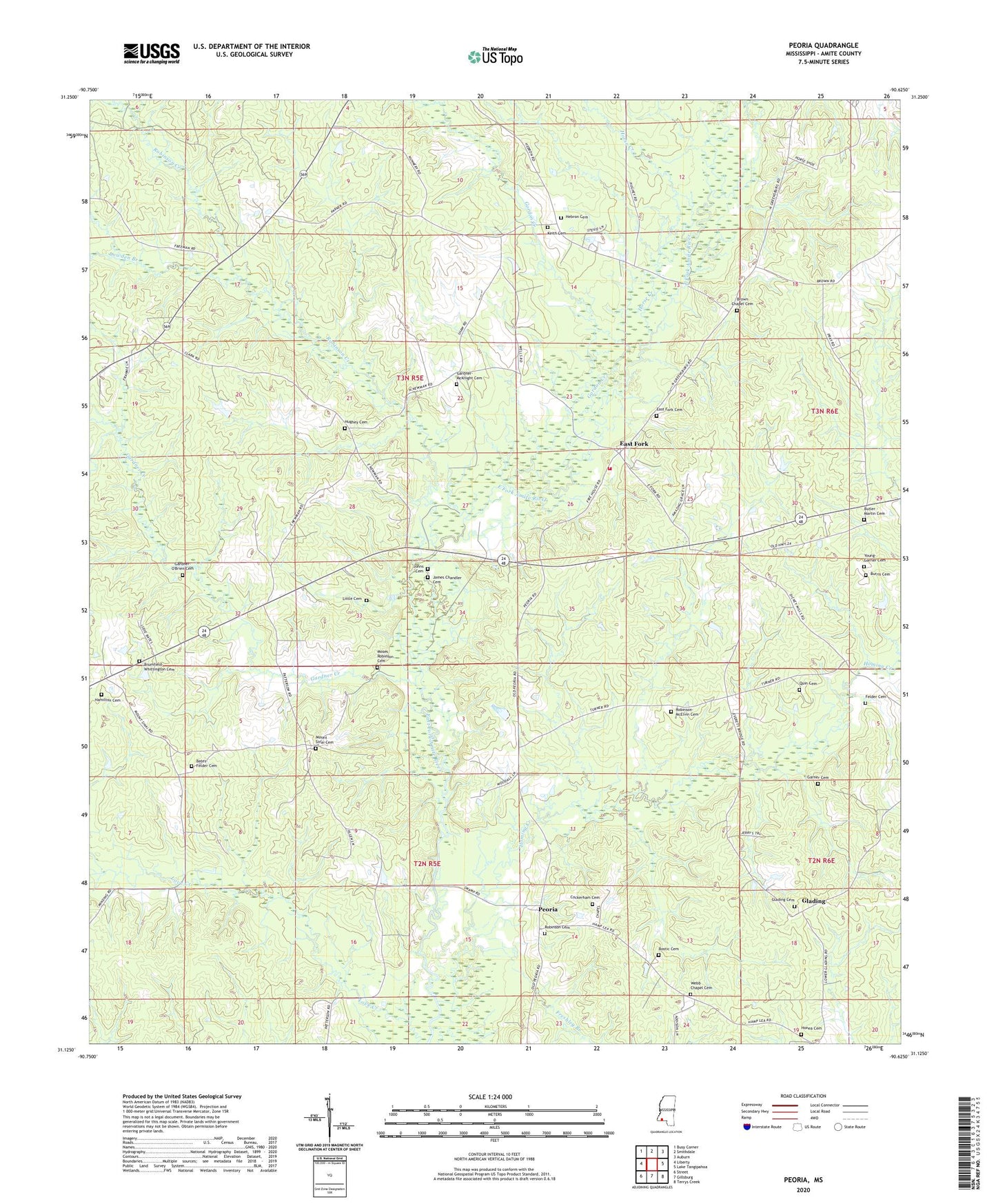
2024 topographic map quadrangle Peoria in the state of Mississippi. Scale: 1:24000. Based on the newly updated USGS 7.5' US Topo map series, this map is in the following counties: Amite. The map contains contour data, water features, and other items you are used to seeing on USGS maps, but also has updated roads and other features. This is the next generation of topographic maps. Printed on high-quality waterproof paper with UV fade-resistant inks.
Quads adjacent to this one:
West: Liberty
Northwest: Busy Corner
North: Smithdale
Northeast: Auburn
East: Lake Tangipahoa
Southeast: Terrys Creek
South: Gillsburg
Southwest: Street
This map covers the same area as the classic USGS quad with code o31090b6.
Contains the following named places: Bates Mill Bridge, Bates-Felder Cemetery, Bostic Cemetery, Brown Chapel Cemetery, Browns Chapel, Brumfield-Whittington Cemetery, Burris Cemetery, Butler - Martin Cemetery, Cochran Chapel, Cockerham Cemetery, Dickey Water Mill, East Central Volunteer Fire Department, East Fork, East Fork Baptist Church, East Fork Cemetery, Fairview School, Felder, Felder Cemetery, Freshley Branch, Gardner Creek, Gardner-McKnight Cemetery, Gardner-O'Brien Cemetery, Garner Cemetery, Glading, Glading Baptist Church, Glading Cemetery, Gordon Creek, Hamilton Cemetery, Hebron, Hebron Baptist Church, Hebron Cemetery, Hominy Creek, Honea Cemetery, Horse Creek, Hughey Cemetery, James Chandler Cemetery, Johns Cemetery, Keith Cemetery, Little Cemetery, Lowden Branch, Marshalton, Moses Robinson Cemetery, Mount Sinai Baptist Church, Mount Sinai Cemetery, Nunnery Store, Peoria, Quin Cemetery, Robinson Baptist Church, Robinson Cemetery, Robinson Creek, Robinson-McElvin Cemetery, Spurlocks, Summers Chapel, Supervisor District 4, Webb Chapel, Webb Chapel Cemetery, Young - Garner Cemetery