MyTopo
Basin Mississippi US Topo Map
Couldn't load pickup availability
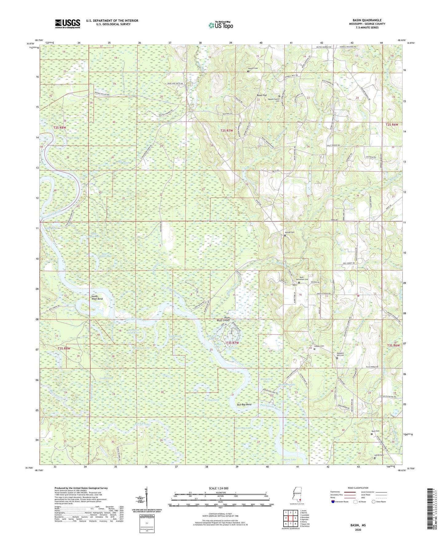
2024 topographic map quadrangle Basin in the state of Mississippi. Scale: 1:24000. Based on the newly updated USGS 7.5' US Topo map series, this map is in the following counties: George. The map contains contour data, water features, and other items you are used to seeing on USGS maps, but also has updated roads and other features. This is the next generation of topographic maps. Printed on high-quality waterproof paper with UV fade-resistant inks.
Quads adjacent to this one:
West: Benndale
Northwest: Avent
North: Merrill
Northeast: Lucedale
East: Agricola
Southeast: Harleston
South: Easen Hill
Southwest: Vestry
This map covers the same area as the classic USGS quad with code o30088g6.
Contains the following named places: Basin, Basin Post Office, Basin School, Basin Volunteer Fire Department, Big Creek, Big Creek Boat Ramp, Bilbo Basin, Bilbo Dead River, Blue Gill Lake, Boneyard Lake, Bream Lake, Bull Bay Bend, Byrd - Helveston Cemetery, Byrd Cemetery, Byrd Mill Branch, Calvary Church, Crossroads Church, Garnett Branch, George County, Gibson Cemetery, Gibson Landing, Gibson Landing Boat Ramp, Goff Dead River, Green Dead River, Harrison Lake, Hilltop Cemetery, Hog Pond, Horseshoe Lake, Howell Cemetery, Lingum Lake, Lower Rines Lake, McCrea Dead River, Mengel Lumber Camp, Mountain, Pascagoula River State Wildlife Management Area, Perch Lake, Peterson Lake, Pierce Lake, Pleasant Hill Church, Plum Bluff Cutoff, Reed Flat, Reed Flat Creek, Sandy Wash Bend, Scott Paper Company Lake Dam, Smith Cutoff, Supervisor District 3, Upper Rines Lake, Wells Lake, White Creek, Wilkerson Ferry, Wilkerson Ferry Boat Ramp, Willie Cockran Estate Lake Dam, Willie Holcomb Lake Dam, Woodard Dead River