MyTopo
Harleston Mississippi US Topo Map
Couldn't load pickup availability
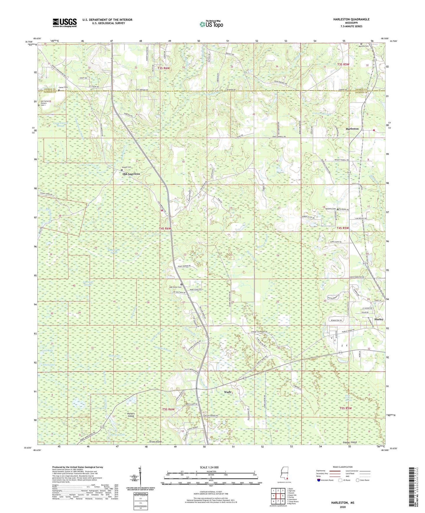
2024 topographic map quadrangle Harleston in the state of Mississippi. Scale: 1:24000. Based on the newly updated USGS 7.5' US Topo map series, this map is in the following counties: Jackson, George. The map contains contour data, water features, and other items you are used to seeing on USGS maps, but also has updated roads and other features. This is the next generation of topographic maps. Printed on high-quality waterproof paper with UV fade-resistant inks.
Quads adjacent to this one:
West: Easen Hill
Northwest: Basin
North: Agricola
Northeast: Howell
East: Hurley
Southeast: Big Point
South: Three Rivers
Southwest: Vancleave
This map covers the same area as the classic USGS quad with code o30088f5.
Contains the following named places: Abundant Grace Church, Americus Courthouse, Bethany Cemetery, Betsy Branch, Black Creek Slough, Camp Ground Slough, Carter Cemetery, Cowerts Branch, East Central High School, Ellick Lake, Files Pond, First Church of God, Good Hope Church, Gopher Island, Harleston, Howell Lake Dam, Hurley Lookout, Hurley Lookout Tower, Jackson Courthouse, John Goff Slough, Johnson Branch, Johnson Chapel, Kenedy Branch, Lices Lake, Little Cedar Creek, Mile Branch, Milstead Branch, Movella Cemetery, Movella Church, Northeast Jackson County Fire Department Station 2, Northeast Jackson County Fire Department Station 7, Oak Grove Cemetery, Oak Grove School, Old Americus, Parkers Island, Parkers Lake, Parker's Lake Boat Ramp, Popetown, Rosedale Church, Salem Church, Sally Lake, Steede Cemetery, Straw Island, Wade, Wade Baptist Church, Wade Census Designated Place, Wade School, Wilson Lake