MyTopo
Baxterville NE Mississippi US Topo Map
Couldn't load pickup availability
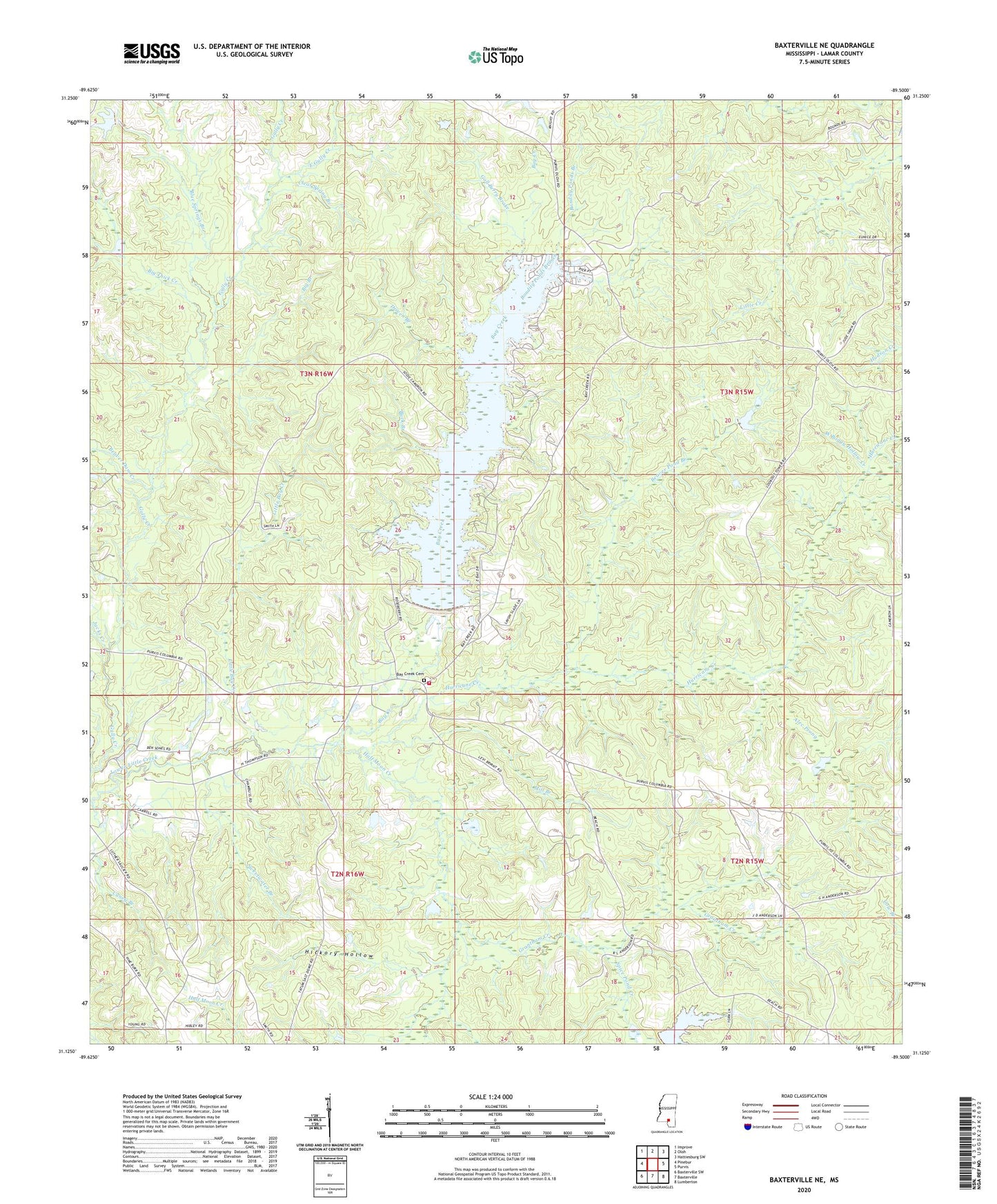
2020 topographic map quadrangle Baxterville NE in the state of Mississippi. Scale: 1:24000. Based on the newly updated USGS 7.5' US Topo map series, this map is in the following counties: Lamar. The map contains contour data, water features, and other items you are used to seeing on USGS maps, but also has updated roads and other features. This is the next generation of topographic maps. Printed on high-quality waterproof paper with UV fade-resistant inks.
Quads adjacent to this one:
West: Pinebur
Northwest: Improve
North: Oloh
Northeast: Hattiesburg SW
East: Purvis
Southeast: Lumberton
South: Baxterville
Southwest: Baxterville SW
Contains the following named places: Alec Prong, Bay Creek, Bay Creek Cemetery, Bay Creek Church, Beaver Dam Creek, Beaver Pond Branch, Big Branch, Big Thick Creek, Blue Springs Branch, Bondity Ponds Branch, Buck Branch, Burnt School, Caney Church, Clear Spring Branch, Driven Branch, East Gully Creek, Gall Berry Brake, Grantham Creek, Greenville Church, Gum Reed Brake, Half Moon Creek, Hickory Hollow, Hurricane Creek, Jacks Creek, Lamar County, Lamar County Volunteer Fire Department, Lamar Lookout Tower, Little Bay Creek, Mill Branch, Spice Pond Creek, Supervisor District 3, Sweetwater Branch, Tatums Camps, Wolf Branch, York S Lake Dam