MyTopo
Improve Mississippi US Topo Map
Couldn't load pickup availability
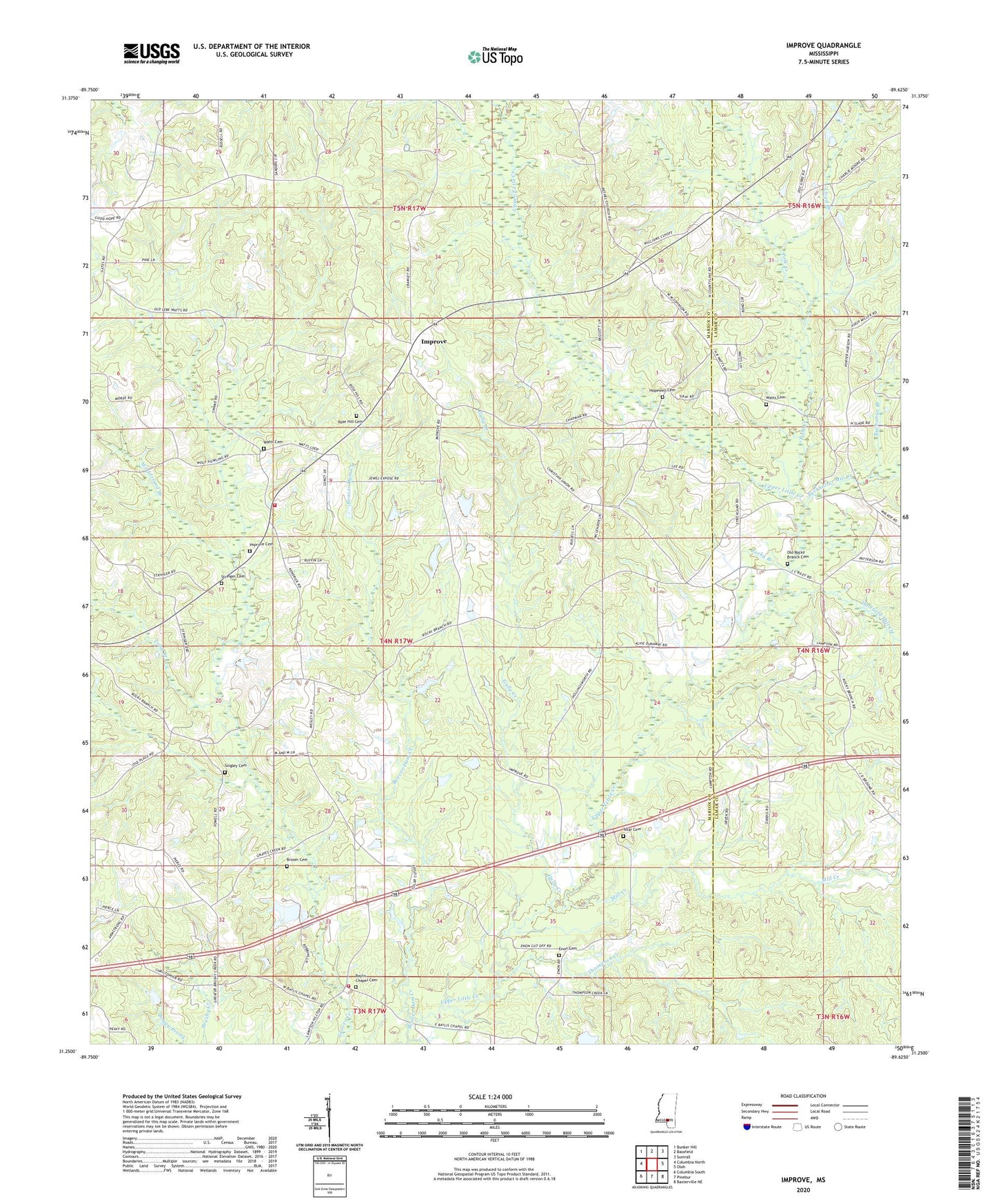
2024 topographic map quadrangle Improve in the state of Mississippi. Scale: 1:24000. Based on the newly updated USGS 7.5' US Topo map series, this map is in the following counties: Marion, Lamar. The map contains contour data, water features, and other items you are used to seeing on USGS maps, but also has updated roads and other features. This is the next generation of topographic maps. Printed on high-quality waterproof paper with UV fade-resistant inks.
Quads adjacent to this one:
West: Columbia North
Northwest: Bunker Hill
North: Bassfield
Northeast: Sumrall
East: Oloh
Southeast: Baxterville NE
South: Pinebur
Southwest: Columbia South
This map covers the same area as the classic USGS quad with code o31089c6.
Contains the following named places: Advent Church, Baylis Chapel, Baylis Chapel Cemetery, Beaver Dam Creek, Bob Branch, Broom Cemetery, Buchanan Branch, Buckhalter Mill Creek, Christian Union Church, Cook Creek, East Marion Community Center, Enon, Enon Cemetery, Enon Church, Ford Branch, Graves Creek Church, Gully Creek, Hartfield Mill Creek, Hopewell, Hopewell Cemetery, Hopewell Church, Hopewell School, Improve, Improve Cemetery, Improve Church, Improve Lookout Tower, Improve Oil Field, Improve School, La Marion School, Lloyd Branch, Long Branch, Lott School, Mill Creek, Old Advance Church, Old Rocky Branch Cemetery, Parkers Chapel, Polk Creek, Rocky Branch, Rocky Branch Church, Rocky Branch School, Rose Hill Cemetery, Rose Hill Church, Saint Marys Church, Singley Cemetery, Singley Lake Dam, Stogner Lake Dam, Stringer Cemetery, Supervisor District 1, Thompson Creek, Tolar Cemetery, Tri Community Volunteer Fire Department Station 3, Tri Community Volunteer Fire Department Station 5, W E Stogner Lake Dam, Watts Cemetery, Watts School, Wolf Island Branch