MyTopo
Pinebur Mississippi US Topo Map
Couldn't load pickup availability
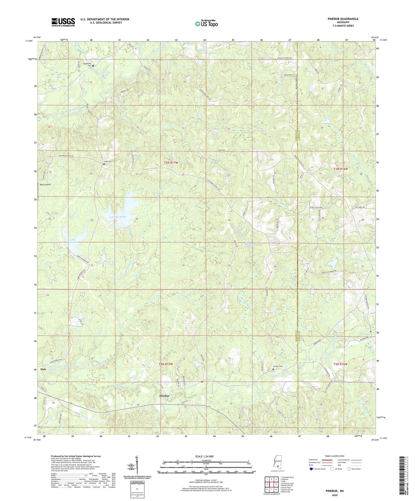
2024 topographic map quadrangle Pinebur in the state of Mississippi. Scale: 1:24000. Based on the newly updated USGS 7.5' US Topo map series, this map is in the following counties: Marion, Lamar. The map contains contour data, water features, and other items you are used to seeing on USGS maps, but also has updated roads and other features. This is the next generation of topographic maps. Printed on high-quality waterproof paper with UV fade-resistant inks.
Quads adjacent to this one:
West: Columbia South
Northwest: Columbia North
North: Improve
Northeast: Oloh
East: Baxterville NE
Southeast: Baxterville
South: Baxterville SW
Southwest: Sandy Hook
This map covers the same area as the classic USGS quad with code o31089b6.
Contains the following named places: Beaver Dam Creek, Beets Airport, Big Creek, Bill Waller Lake Dam, Boggy Prong, Breakfield Cemetery, Brushy Creek, Brushy Creek Church, Caney Branch, Cook Cemetery, Earkan Lake Dam, Elbow Branch, Graves Creek, Gully Creek, Hollywood Spring, Lake Bill Waller, Lake Columbia, Lake Columbia Dam, Lake Watts, Little Prong Creek, Long Branch, Marion County State Wildlife Management Area, Mill Branch, Pine Burr Volunteer Fire Department, Pinebur, Pinebur Cemetery, Pinebur Church, Pitman Creek, Pitman Creek School, Sheep Pen Branch, Supervisor District 5, Tom Watts Lake Dam, Turkey Branch, Union School