MyTopo
Bellewood Mississippi US Topo Map
Couldn't load pickup availability
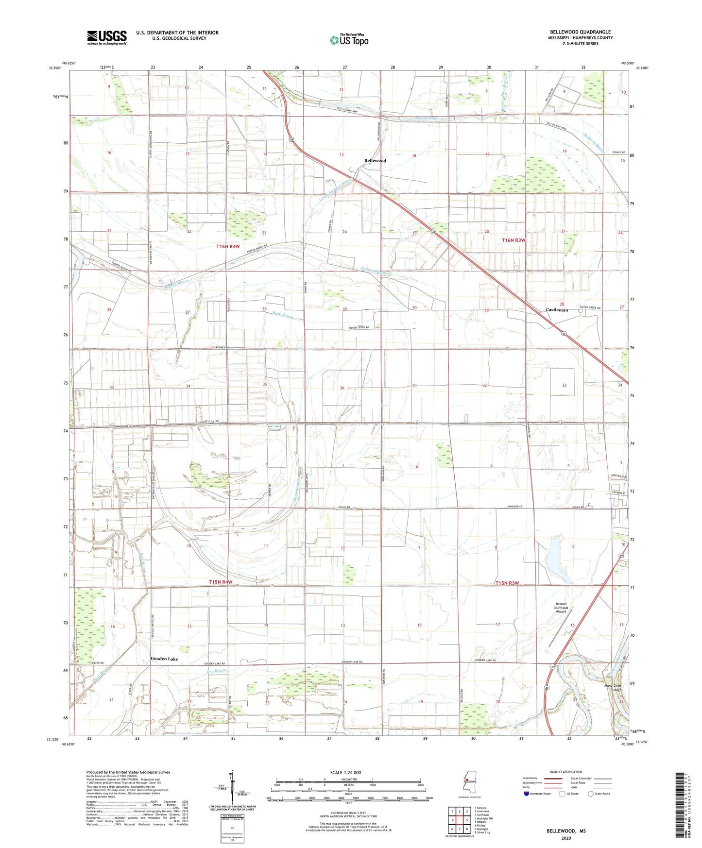
2020 topographic map quadrangle Bellewood in the state of Mississippi. Scale: 1:24000. Based on the newly updated USGS 7.5' US Topo map series, this map is in the following counties: Humphreys. The map contains contour data, water features, and other items you are used to seeing on USGS maps, but also has updated roads and other features. This is the next generation of topographic maps. Printed on high-quality waterproof paper with UV fade-resistant inks.
Quads adjacent to this one:
West: Midnight NW
Northwest: Kinlock
North: Inverness
Northeast: Swiftown
East: Belzoni
Southeast: Silver City
South: Midnight
Southwest: Richey
Contains the following named places: A B Evans Lake Dam, Beautiful Zion Church, Beaver Dam Bayou, Beckwith Lake Dam, Bellewood, Bellewood Church, Belzoni Municipal Airport, Blue Sack Landing, Bridges Landing, Castleman, Cold Lake, Cold Lake Church, Cold Lake School, D E C Farms Pond Dam, Daybreak Chapel, Daybreak Plantation, Delta Company Pond Dam, Dry Bayou, Duke Lake Dam, Edward Brothers Pond Dam, Ell Chapel, Freedmans Bureau Landing, G B Mortarman Pond Dam, Goat Hill Landing, Gooden Lake, Gooden Lake Church, Gooden Lake School, H D Tharp Pond Dam, H O Tharp Dam, Hard Cash, Hard Cash Cutoff, Hard Cash Lake, Hill and Sons Lake Dam, Humphreys County, Liberty Church, Little Atchafalaya Bayou, Little Jackson Bayou, Morganza Landing, Mortimer Lake Dam, Mount Carmel Church, Mount Carmel Elementary School, Mrs S O Tharp Lake Dam, Pickell Lake Dam, R D Bearden Pond Dam, S B Thorton Lake Dam, S L Reed Lake Dam, Shady Grove Church, Shiloh Church, Springwood Landing, T W Aust Ponds Dam, Tepper Elementary School, Tharp Lake Dam, Thomas Turner Lake Dam, Tirey Lake Dam, Tupper Bayou, Turner Field, Tuscola Landing, Zion Traveler Church, ZIP Code: 38754