MyTopo
Swiftown Mississippi US Topo Map
Couldn't load pickup availability
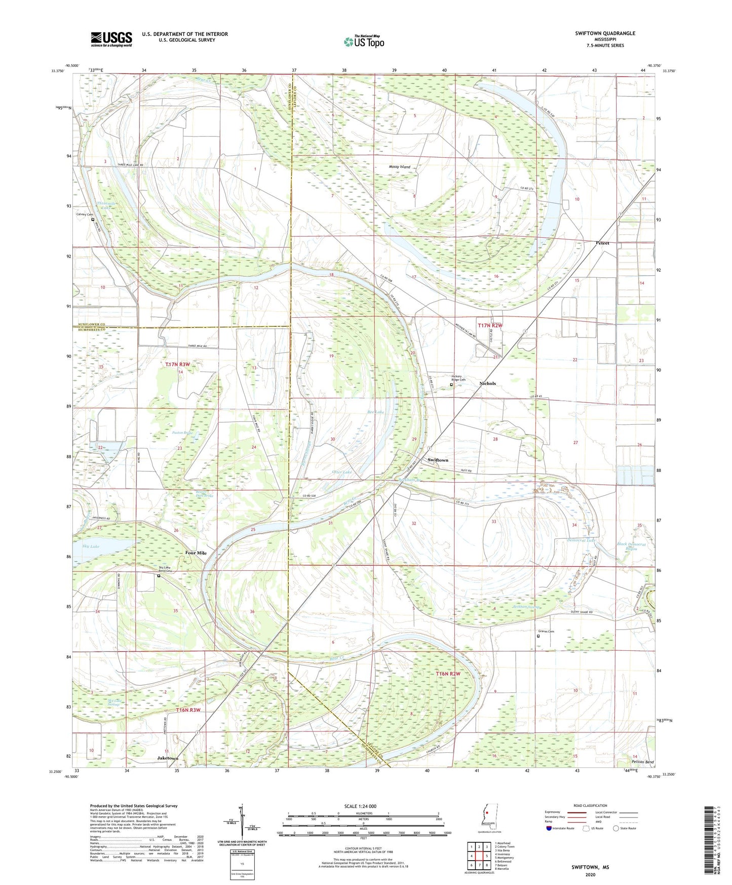
2024 topographic map quadrangle Swiftown in the state of Mississippi. Scale: 1:24000. Based on the newly updated USGS 7.5' US Topo map series, this map is in the following counties: Leflore, Humphreys, Sunflower. The map contains contour data, water features, and other items you are used to seeing on USGS maps, but also has updated roads and other features. This is the next generation of topographic maps. Printed on high-quality waterproof paper with UV fade-resistant inks.
Quads adjacent to this one:
West: Inverness
Northwest: Moorhead
North: Colony Town
Northeast: Itta Bena
East: Montgomery
Southeast: Marcella
South: Belzoni
Southwest: Bellewood
This map covers the same area as the classic USGS quad with code o33090c4.
Contains the following named places: Beaver Dam Brake, Beckham Branch, Beckham Swamp, Bee Lake, Bethlehem Church, Black Democrat Bayou, Burns Slough, Calvary Cemetery, Calvery Church, Church of God, Cypress Grove Church, Democrat Lake, Dollar Lake, Eggleston Spur, Elizabeth Church, Four Mile, Fourmile Lake, Graves Cemetery, Greentree State Waterfowl Production Area, Hickory Ridge Cemetery, Indian Mound Church, Jaketown, King Lake Dam, Little Mossy Lake, Macon Lake, Mathews Crossing, Mossy Island, Mossy Lake, Mossy Run Lake, Mount Pleasant Church, Mount Pleasant School, New Prospect Church, Nichols, Otter Lake, Paxton Brake, Perkins, Peteet, Pleasant Green Church, Seitz, Shell Brake, Sixmile Lake, Sky Lake, Sky Lake Bend Cemetery, Sky Lake Swamp, Swiftown, Swiftown Church of God in Christ, T W Aust Ponds, Threemile Lake, Wades Chapel, Wakes Valley Landing, Walkers Lake, White Rock Church, ZIP Codes: 38946, 38958