MyTopo
Brooks Mississippi US Topo Map
Couldn't load pickup availability
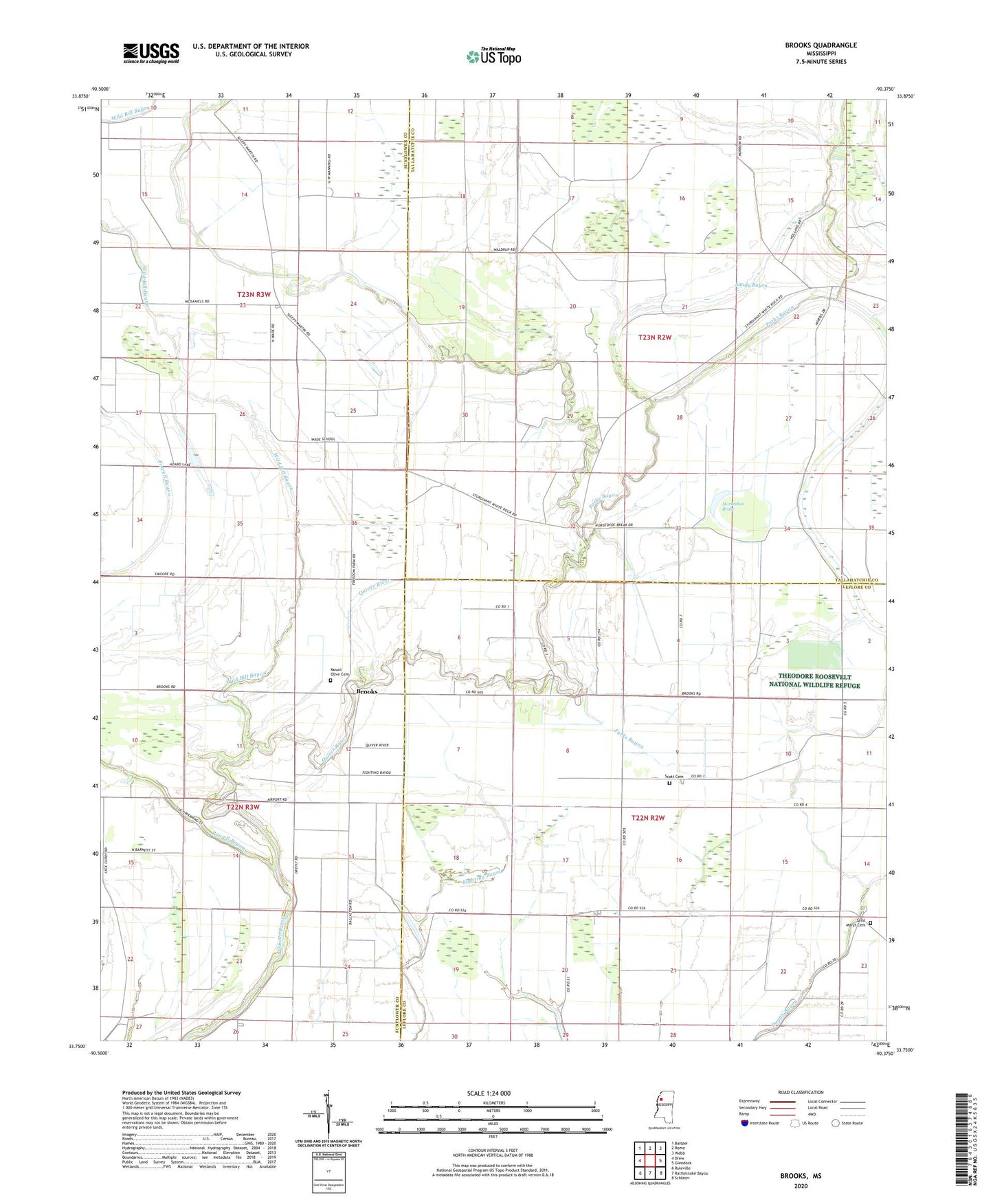
2020 topographic map quadrangle Brooks in the state of Mississippi. Scale: 1:24000. Based on the newly updated USGS 7.5' US Topo map series, this map is in the following counties: Sunflower, Tallahatchie, Leflore. The map contains contour data, water features, and other items you are used to seeing on USGS maps, but also has updated roads and other features. This is the next generation of topographic maps. Printed on high-quality waterproof paper with UV fade-resistant inks.
Quads adjacent to this one:
West: Drew
Northwest: Baltzer
North: Rome
Northeast: Webb
East: Glendora
Southeast: Schlater
South: Rattlesnake Bayou
Southwest: Ruleville
Contains the following named places: Brookland School, Brooks, Brooks Chapel, Brooks School, Cane Lake, Church of God, Clover Hill Church, East Mount Olive Church, Green Grove Church, Hoard Lake, Holmes Chapel, Horseshoe Brake, Johnson Chapel, Merry Grove Church, Morning Star Church, Mount Olive Cemetery, Newlight Church, Parks Bayou, Parks Church, Powell Bayou, Saint Marys Cemetery, Saint Marys Church, Scott Cemetery, Wade, Wade School, Wild Bill Bayou