MyTopo
Rome Mississippi US Topo Map
Couldn't load pickup availability
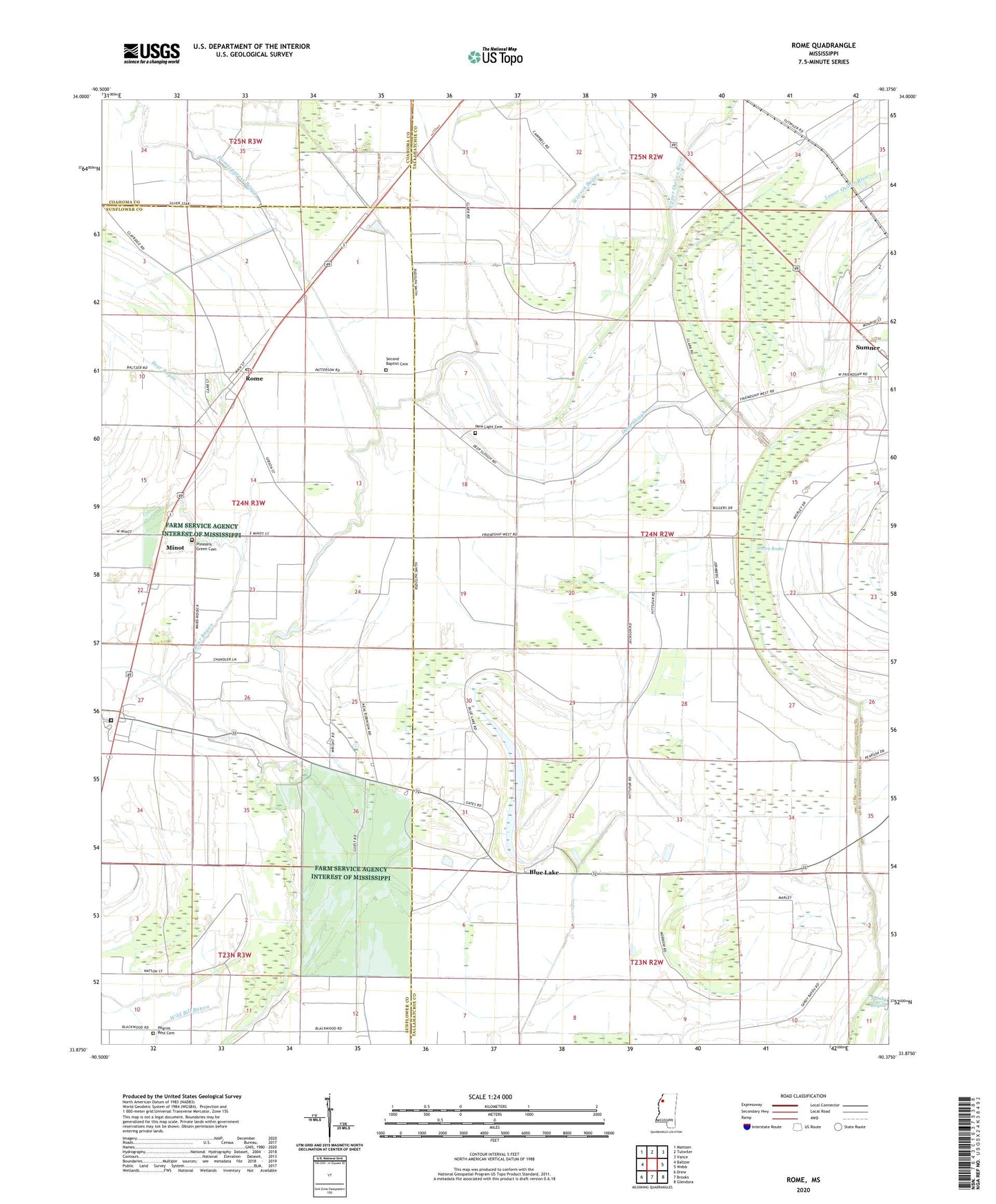
2024 topographic map quadrangle Rome in the state of Mississippi. Scale: 1:24000. Based on the newly updated USGS 7.5' US Topo map series, this map is in the following counties: Tallahatchie, Sunflower, Coahoma. The map contains contour data, water features, and other items you are used to seeing on USGS maps, but also has updated roads and other features. This is the next generation of topographic maps. Printed on high-quality waterproof paper with UV fade-resistant inks.
Quads adjacent to this one:
West: Baltzer
Northwest: Mattson
North: Tutwiler
Northeast: Vance
East: Webb
Southeast: Glendora
South: Brooks
Southwest: Drew
This map covers the same area as the classic USGS quad with code o33090h4.
Contains the following named places: Bear Bayou, Blue Lake, Deep Slough, Flautt, Friendship West Church, Hitt Chapel, Hitt Spur, Homecypress Bayou, Lower Quiver River, Minot, Mississippi State Penitentiary, Mount Carmel Church, New Bethel Church, New Light Cemetery, New Light Church, Oakland Mount Olive Church, Parchman, Pentecostal Church of God, Peterson Church, Pilgrim Rest Cemetery, Pilgrims Rest Church, Pleasant Green Cemetery, Pleasant Green Church, Rome, Rome Baptist Church, Rome Post Office, Rome School, Rome United Methodist Church, Saint John Church, Sandy Bayou, Second Baptist Cemetery, Second Baptist Church, Silver Star Church, Staten Brake, Supervisor District 5, Sweet Home Church, Trotten Plantation, Upper Quiver River, Watson Bayou, ZIP Code: 38768