MyTopo
Baltzer Mississippi US Topo Map
Couldn't load pickup availability
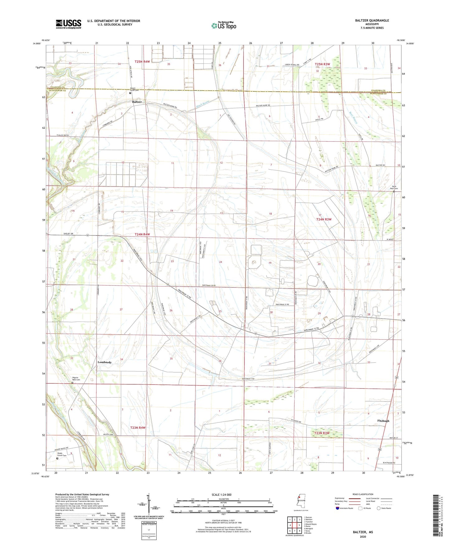
2024 topographic map quadrangle Baltzer in the state of Mississippi. Scale: 1:24000. Based on the newly updated USGS 7.5' US Topo map series, this map is in the following counties: Sunflower, Coahoma. The map contains contour data, water features, and other items you are used to seeing on USGS maps, but also has updated roads and other features. This is the next generation of topographic maps. Printed on high-quality waterproof paper with UV fade-resistant inks.
Quads adjacent to this one:
West: Mound Bayou
Northwest: Duncan
North: Mattson
Northeast: Tutwiler
East: Rome
Southeast: Brooks
South: Drew
Southwest: Merigold
This map covers the same area as the classic USGS quad with code o33090h5.
Contains the following named places: Baltzer, Black Bayou, Black Bayou School, Boisy School, Church of God, Fitzhugh, Floyd Haney Pond Dam, Goldfield Plantation, Lombardy, Lombardy School, Mount Olive Cemetery, New Jerusalem Church, North Mount Olive Church, Pilgrim Rest Cemetery, Pilgrim Rest Church, Saint Paul Cemetery, Shady Grove Cemetery, Sid Dodd Plantation, Sid Dodd School, Skiff Lake, State Penal Camp Farm Number 5, State Penal Camp Farm Number 7, State Penal Farm Camp Number 10, State Penal Farm Camp Number 11, State Penal Farm Camp Number 12, State Penal Farm Camp Number 2, State Penal Farm Camp Number 3, State Penal Farm Camp Number 4, State Penal Farm Camp Number 6, State Penal Farm Camp Number 8, State Penal Farm Camp Number 9, Zion Travel Church, ZIP Code: 38738