MyTopo
Brooksville Mississippi US Topo Map
Couldn't load pickup availability
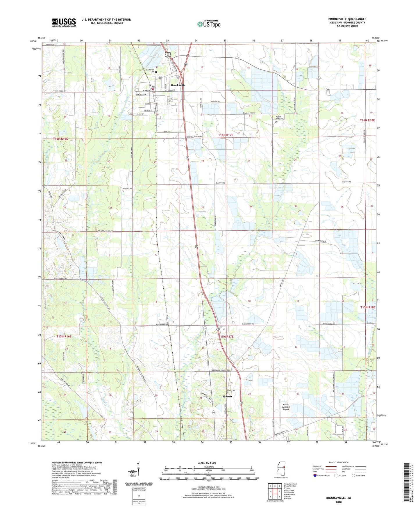
2020 topographic map quadrangle Brooksville in the state of Mississippi. Scale: 1:24000. Based on the newly updated USGS 7.5' US Topo map series, this map is in the following counties: Noxubee. The map contains contour data, water features, and other items you are used to seeing on USGS maps, but also has updated roads and other features. This is the next generation of topographic maps. Printed on high-quality waterproof paper with UV fade-resistant inks.
Quads adjacent to this one:
West: Lynn Creek
Northwest: Crawford West
North: Crawford East
Northeast: Trinity
East: Cliftonville
Southeast: McLeod
South: Macon
Southwest: Mashulaville
Contains the following named places: Armitage, Britt Farm Lake Dam, Brooksville, Brooksville Baptist Church, Brooksville Cemetery, Brooksville Fire Department, Brooksville First Pentecostal Church, Brooksville High School, Brooksville Post Office, Camp Rockbrook, Cedar Creek Fire Department District 3, Centerville Church, Civil Ridge Church, Eagle Banners Ranch Lake Dam, Edwards Store, Erickson Lake Dam, Friendship Church, Greenfield Church, Halls Cemetery, Hopewell Church, Horse Hunters Prairie, Lucas Store, Macedonia Church, Macon Municipal Airport, Magnolia Church, Mishula Tubba Prairie, Mount Carmel Church, Mount Moriah Church, Pilgrim Rest Cemetery, Pilgrim Rest Church, Stockards Store, Tabernacle Church, Tolliver Cemetery, Tolliver Chapel, Town of Brooksville, Union Chapel, Wilson Attendance Center, Woods Lake Dam, ZIP Code: 39739