MyTopo
Cliftonville Mississippi US Topo Map
Couldn't load pickup availability
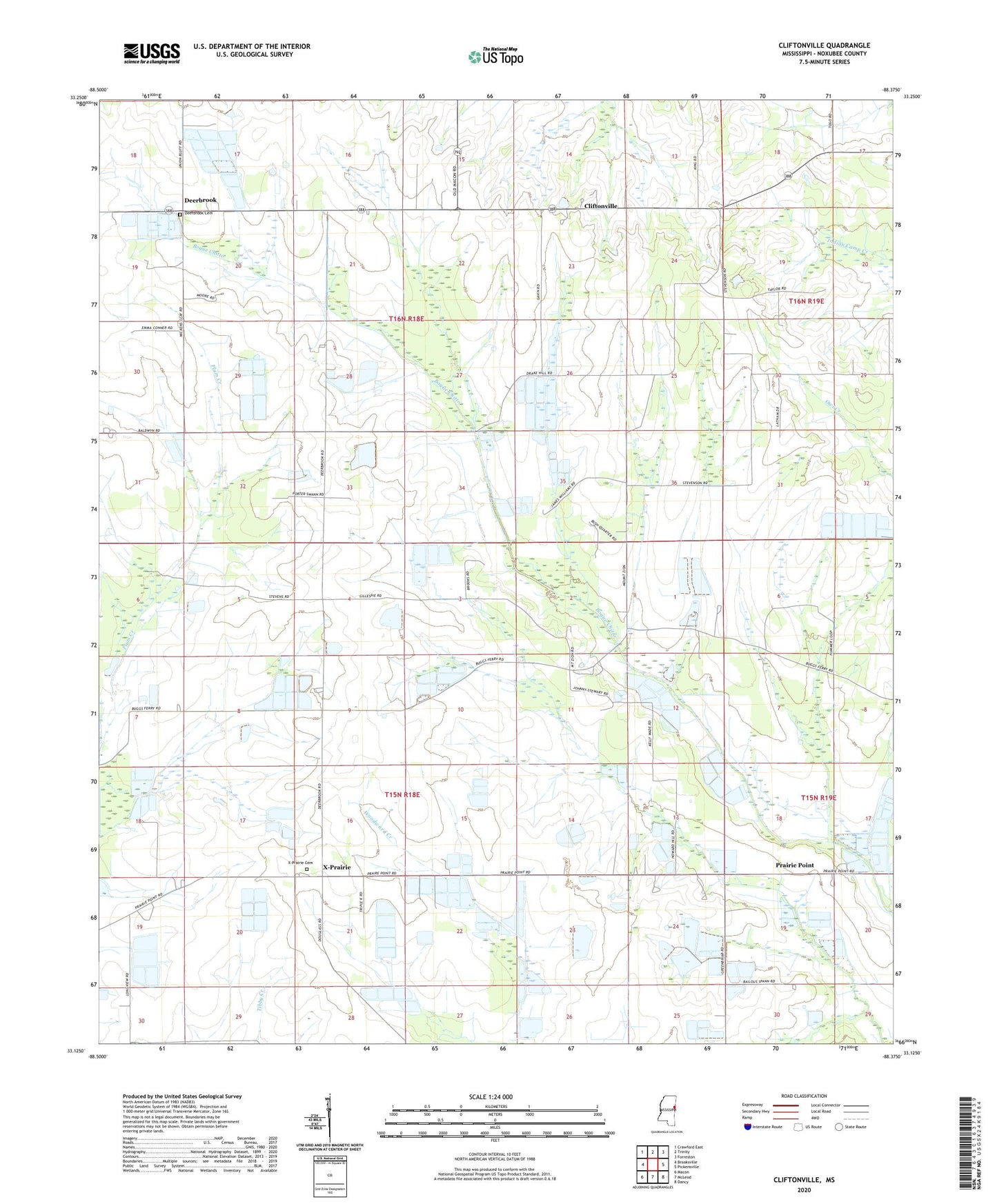
2024 topographic map quadrangle Cliftonville in the state of Mississippi. Scale: 1:24000. Based on the newly updated USGS 7.5' US Topo map series, this map is in the following counties: Noxubee. The map contains contour data, water features, and other items you are used to seeing on USGS maps, but also has updated roads and other features. This is the next generation of topographic maps. Printed on high-quality waterproof paper with UV fade-resistant inks.
Quads adjacent to this one:
West: Brooksville
Northwest: Crawford East
North: Trinity
Northeast: Forreston
East: Pickensville
Southeast: Dancy
South: McLeod
Southwest: Macon
This map covers the same area as the classic USGS quad with code o33088b4.
Contains the following named places: Baldwin Church, Cavetts Store, Cliftonville, Coles Store, Deerbrook, Deerbrook Cemetery, Deerbrook Lookout Tower, Drake Hill Church, Mennonite Church of God in Christ, Mount Bethel Church, Mount Horton Church, Mount Zion Church, New Bethel Church, New Hope Church, Pilgrim Grove Church, Prairie Point, Prairie Point Post Office, Second James Creek Church, South Haven Church, South Haven School, Supervisor District 1, Woodlawn Church, X-Prairie, X-Prairie Cemetery, X-Prairie Methodist Church