MyTopo
Carnes Mississippi US Topo Map
Couldn't load pickup availability
Also explore the Carnes Forest Service Topo of this same quad for updated USFS data
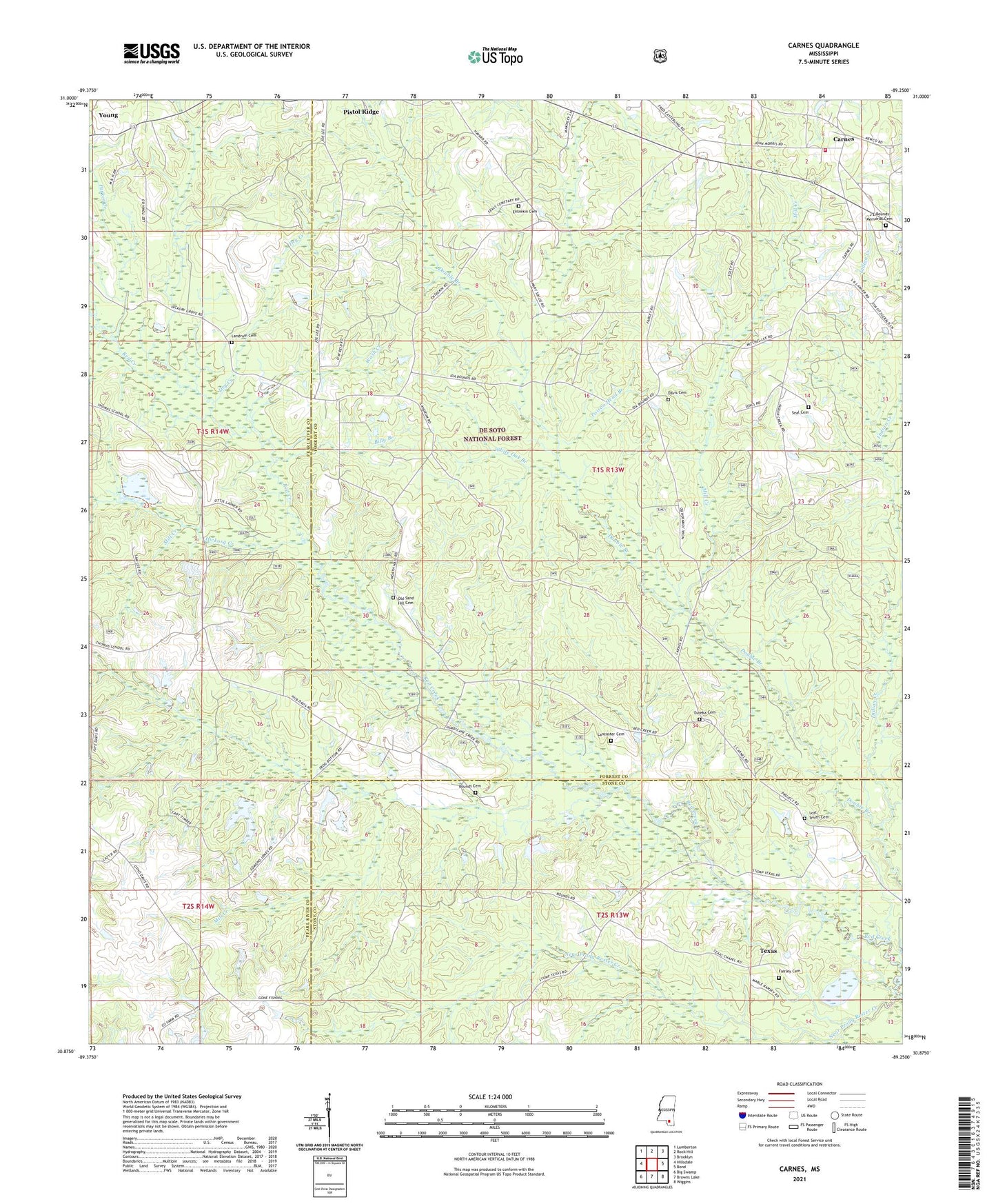
2024 topographic map quadrangle Carnes in the state of Mississippi. Scale: 1:24000. Based on the newly updated USGS 7.5' US Topo map series, this map is in the following counties: Forrest, Pearl River, Stone. The map contains contour data, water features, and other items you are used to seeing on USGS maps, but also has updated roads and other features. This is the next generation of topographic maps. Printed on high-quality waterproof paper with UV fade-resistant inks.
Quads adjacent to this one:
West: Hillsdale
Northwest: Lumberton
North: Rock Hill
Northeast: Brooklyn
East: Bond
Southeast: Wiggins
South: Browns Lake
Southwest: Big Swamp
This map covers the same area as the classic USGS quad with code o30089h3.
Contains the following named places: Billy Branch, Bounds Cemetery, Carnes, Carnes Volunteer Fire Department Station 1, Dana Creek, Davis Cemetery, Dry Creek, Entrekin Cemetery, Eureka Cemetery, Fairley Cemetery, Hickory Creek, Hickory Creek Church, Hurricane Creek, Indian Creek, J E Bounds Memorial Cemetery, Lancaster Cemetery, Landrum Cemetery, Lee Town Church, Lott Smith Cemetery, Maxie Oil and Gas Field, Mill Creek, Mill Creek Church, Near Prong Rester Creek, Old Sandhill Church, Pistol Ridge Oil and Gas Field, Poison Head Branch, Sand Ridge School, Sandhill Church, Seal Cemetery, Texas, Thomas School, Wash Creek, White Oak Branch, Young