MyTopo
Chunky Mississippi US Topo Map
Couldn't load pickup availability
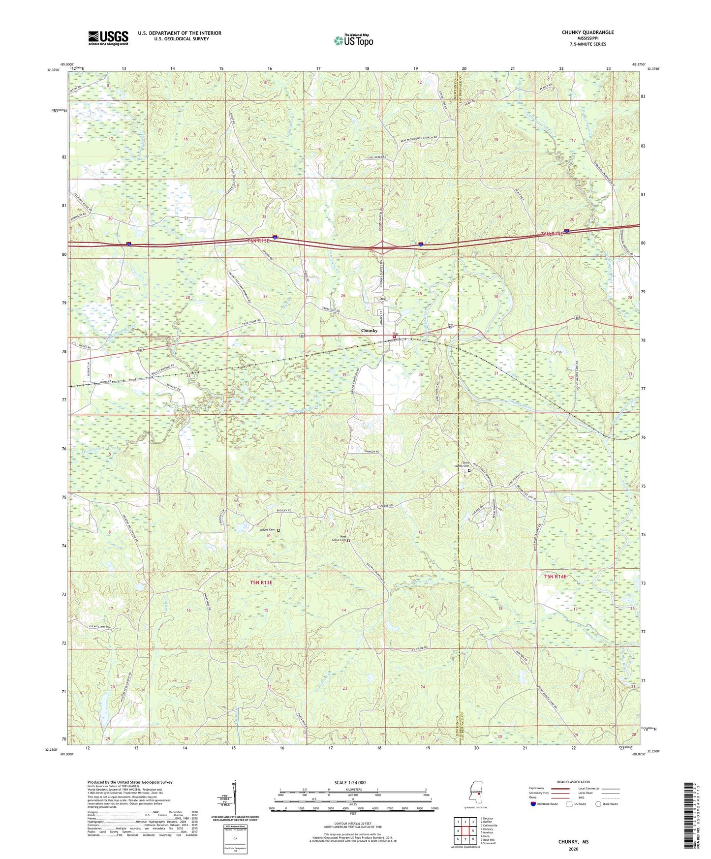
2020 topographic map quadrangle Chunky in the state of Mississippi. Scale: 1:24000. Based on the newly updated USGS 7.5' US Topo map series, this map is in the following counties: Newton, Lauderdale. The map contains contour data, water features, and other items you are used to seeing on USGS maps, but also has updated roads and other features. This is the next generation of topographic maps. Printed on high-quality waterproof paper with UV fade-resistant inks.
Quads adjacent to this one:
West: Hickory
Northwest: Decatur
North: Duffee
Northeast: Collinsville
East: Meehan
Southeast: Stonewall
South: Rose Hill
Southwest: Hero
Contains the following named places: African Church, Blue Branch, Bogue Flower, Bogue Statinea, Chunky, Chunky Baptist Church, Chunky Creek, Chunky Post Office, Consolidated School, Germeny Lake Dam, Good Hope Church, Green Grove Church, Little Union, McGee Cemetery, Mount Moriah Church, Mount Pleasant Church, Mrs Graham Lake Dam, New Providence, New Providence Church, Okahatta Creek, Peavy Pond Dam, Pine Forest Academy, Pine Forest Academy Pond Dam, Pine Forest Hospital, Pine Grove Cemetery, Pine Grove Church, Pine Grove School, Point, Possum Creek, Potterchitto Creek, Rasland, Saint Marks Cemetery, Saint Marks Church, Sharps Store, Tallahatta Creek, Tonacana Creek, Town of Chunky, Truelight Church, Union Church, ZIP Codes: 39323, 39332