MyTopo
Hickory Mississippi US Topo Map
Couldn't load pickup availability
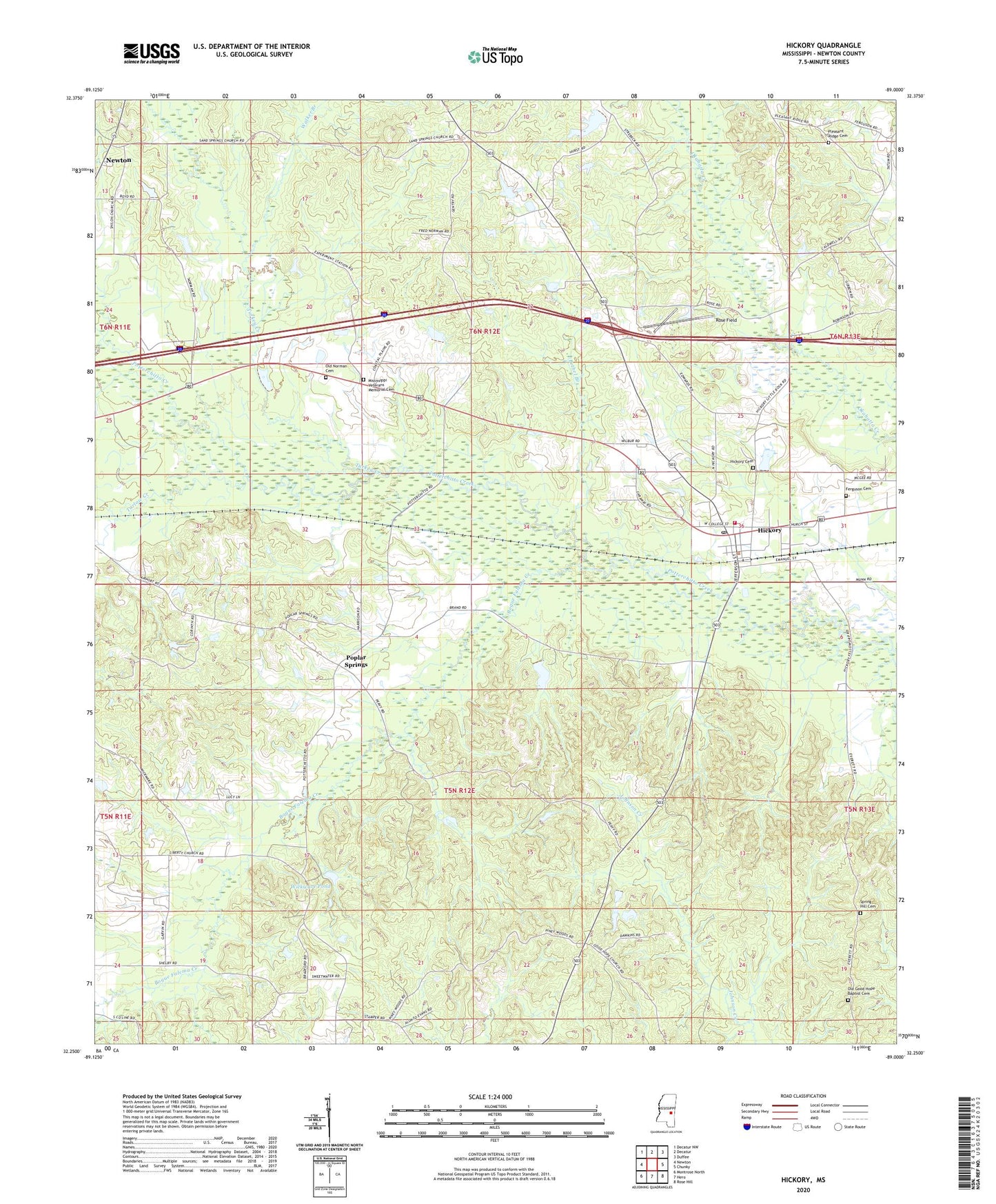
2024 topographic map quadrangle Hickory in the state of Mississippi. Scale: 1:24000. Based on the newly updated USGS 7.5' US Topo map series, this map is in the following counties: Newton. The map contains contour data, water features, and other items you are used to seeing on USGS maps, but also has updated roads and other features. This is the next generation of topographic maps. Printed on high-quality waterproof paper with UV fade-resistant inks.
Quads adjacent to this one:
West: Newton
Northwest: Decatur NW
North: Decatur
Northeast: Duffee
East: Chunky
Southeast: Rose Hill
South: Hero
Southwest: Montrose North
This map covers the same area as the classic USGS quad with code o32089c1.
Contains the following named places: Antioch Chistian Church, B J Blount Lake Dam, Berry School, Bethel Branch, Bethel Church, Bogue Falema Creek, Chunky, Corinth Church, Fahrbach Lake Dam, Ferguson Cemetery, Hammond Store, Hickman Chapel School, Hickory, Hickory Attendance Center, Hickory Cemetery, Hickory Post Office, Hickory Volunteer Fire Department, Liberty, Liberty Church, Mississippi State Experimental Station, Mount Moriah Church, Mount Olive Church, Newton Lookout Tower, Old Good Hope Baptist Cemetery, Old Norman Cemetery, Paula, Pleasant Ridge Baptist Church, Pleasant Ridge Cemetery, Poplar Springs, Poplar Springs Church, R Doolittle Pond Dam, Rock Hill Church, Rose Field, Saint Paul School, Sand Springs Church, Shiloh Church, Simmons Branch, Spring Hill Cemetery, Supervisor District 5, Sweetwater School, Tallow, Tarlow Creek, Town of Hickory, Troy Brand Lake Dam, Turkey Creek, Urbo, W Parks Lake Dam, Walker Branch, Wall School, Wickward, Wickware Pond, ZIP Code: 39345