MyTopo
Decatur Mississippi US Topo Map
Couldn't load pickup availability
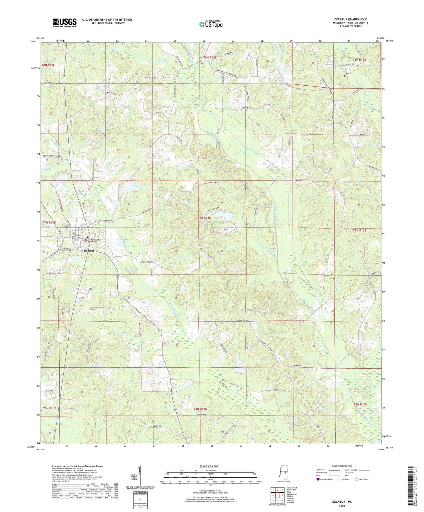
2024 topographic map quadrangle Decatur in the state of Mississippi. Scale: 1:24000. Based on the newly updated USGS 7.5' US Topo map series, this map is in the following counties: Newton. The map contains contour data, water features, and other items you are used to seeing on USGS maps, but also has updated roads and other features. This is the next generation of topographic maps. Printed on high-quality waterproof paper with UV fade-resistant inks.
Quads adjacent to this one:
West: Decatur NW
Northwest: Union West
North: Union East
Northeast: Post
East: Duffee
Southeast: Chunky
South: Hickory
Southwest: Newton
This map covers the same area as the classic USGS quad with code o32089d1.
Contains the following named places: B L Griffin Lake Dam, Beulah Church, Beulah School, Blounts Store, Brand Cemetery, C Loper Catfish Pond Dam, C M Blount Lake Dam, Carlton Branch, Chaney Store, Chapel Hill School, Chunky Canal, Chunky Watershed Structure 5 Dam, Cleveland Branch, Concobona Creek, Decatur, Decatur Attendance Center, Decatur Branch, Decatur Cemetery, Decatur Police Department, Decatur Post Office, Decatur Volunteer Fire Department, Dry Branch, East Central Community College, Ecjc Lake Dam, Good Hope Church, Goodhope, Graham Store, Greenwood Church, Hale Branch, Hallman Branch, High Heel School, John Cook Branch, Johnson Cemetery, Laird Branch, Lebanon, Lebanon Church, Liberty Hill School, Little Rock, Little Rock Church, Majure Church, McMullan Branch, Midway Church, Newton County, Newton County Sheriff's Office, Oakland Church, Okahatta Canal, Osborn Lake Dam, Ozborn Lake, Reeves Branch, Roman Hill Church, Roscoe, Shady Grove Church, Storys Store, Supervisor District 1, Supervisor District 2, Tallashua Creek, Tommy Graham Pond Dam, Town of Decatur, Williams Store, Witt Creek, Witts School, ZIP Code: 39327