MyTopo
Duffee Mississippi US Topo Map
Couldn't load pickup availability
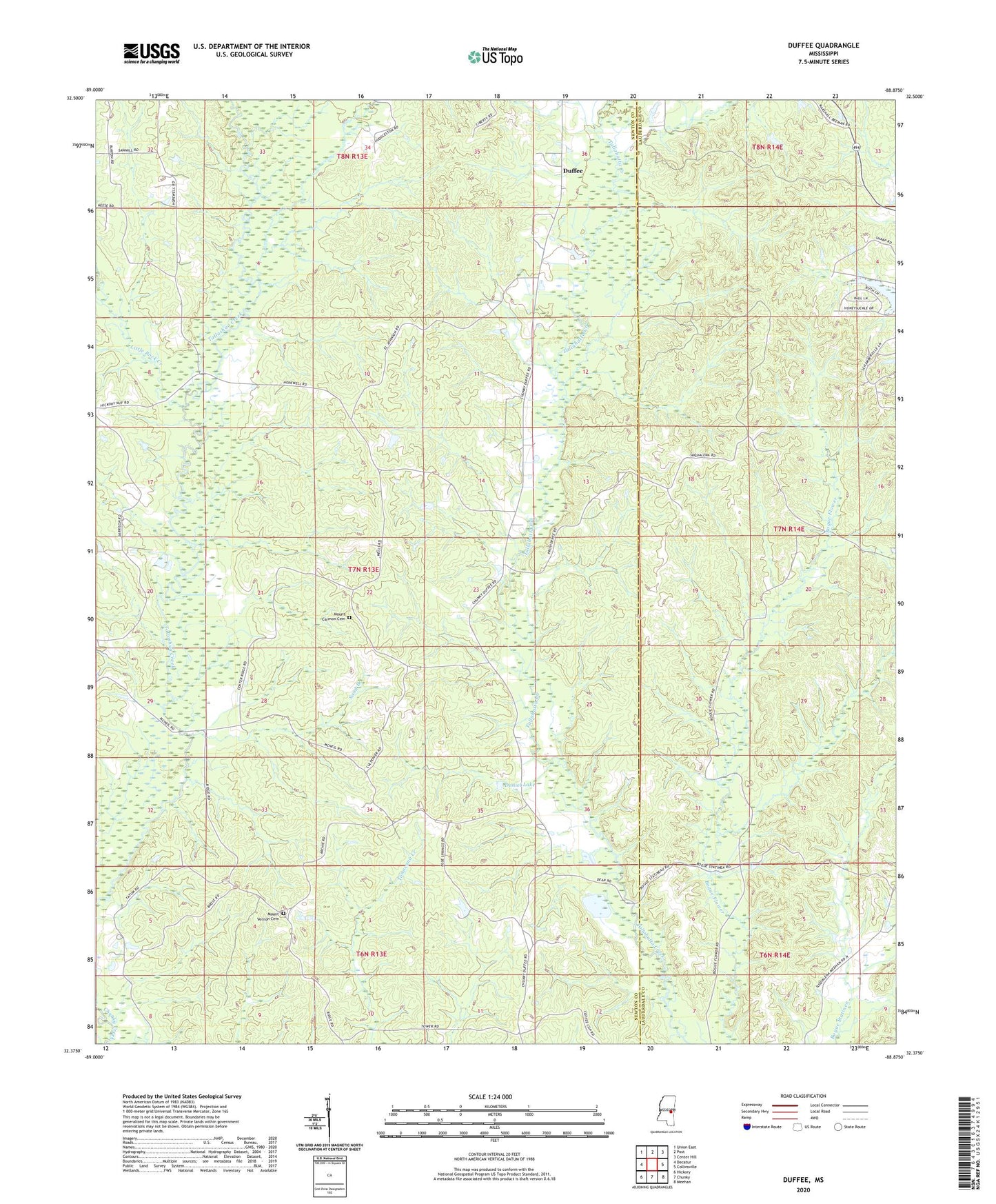
2024 topographic map quadrangle Duffee in the state of Mississippi. Scale: 1:24000. Based on the newly updated USGS 7.5' US Topo map series, this map is in the following counties: Newton, Lauderdale. The map contains contour data, water features, and other items you are used to seeing on USGS maps, but also has updated roads and other features. This is the next generation of topographic maps. Printed on high-quality waterproof paper with UV fade-resistant inks.
Quads adjacent to this one:
West: Decatur
Northwest: Union East
North: Post
Northeast: Center Hill
East: Collinsville
Southeast: Meehan
South: Chunky
Southwest: Hickory
This map covers the same area as the classic USGS quad with code o32088d8.
Contains the following named places: Blackwell School, Blue Springs Church, Center Ridge, Center Ridge Church, Center Ridge School, Daniel Lake, Duffee, Duffee Church, Duffee Volunteer Fire Department, Evergreen, Faith Tabernacle Church, Liberty Church, Little Rock Creek, Mount Carmon Cemetery, Mount Carmon Church, Mount Vernon Cemetery, Mount Vernon Church, Mount Zion Church, Nanahuma Post Office, Oak Grove Church, Oak Grove School, Perota, Providence Church, Rock Hill Church, Sand Branch, Spring Chapel School, Thirteenth School