MyTopo
Coxs Ferry Mississippi US Topo Map
Couldn't load pickup availability
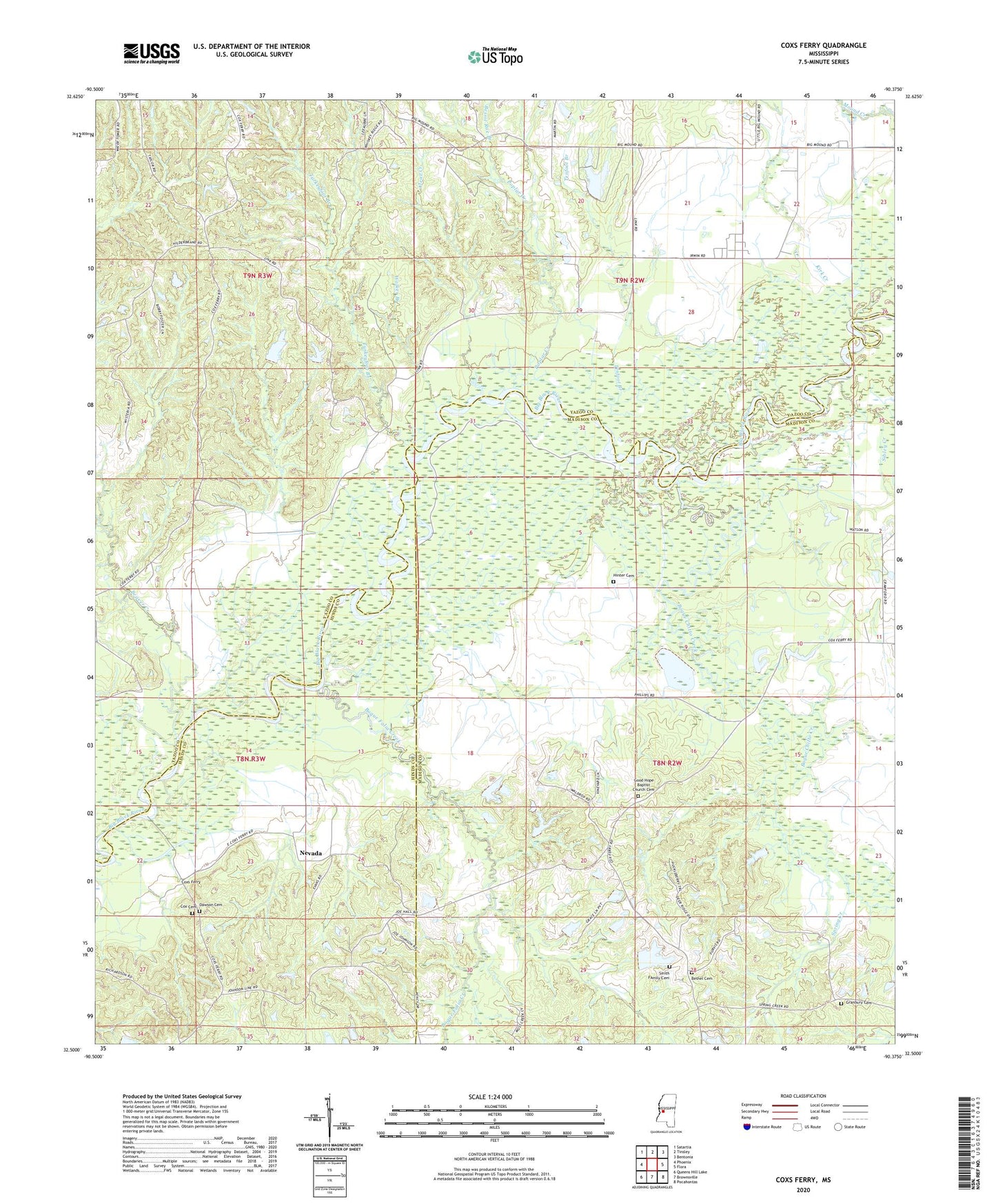
2020 topographic map quadrangle Coxs Ferry in the state of Mississippi. Scale: 1:24000. Based on the newly updated USGS 7.5' US Topo map series, this map is in the following counties: Yazoo, Madison, Hinds. The map contains contour data, water features, and other items you are used to seeing on USGS maps, but also has updated roads and other features. This is the next generation of topographic maps. Printed on high-quality waterproof paper with UV fade-resistant inks.
Quads adjacent to this one:
West: Phoenix
Northwest: Satartia
North: Tinsley
Northeast: Bentonia
East: Flora
Southeast: Pocahontas
South: Brownsville
Southwest: Queens Hill Lake
Contains the following named places: Adelle, Beaver Creek, Bessie Roe Branch, Bethel Cemetery, Bethel Church, Bill Link Pond Dam, Bill Walker Pond Dam, Bogue Chitto Creek, Boque Falia Creek, Buzzard Lake, Clayton Cemetery, Clear Creek, Cox Cemetery, Coxs Ferry, Dawson Cemetery, Evening Star Church, Franklin Church, Freens Chapel, Good Hope Baptist Church Cemetery, Good Hope Missionary Baptist Church, Granbury Cemetery, H Johnson Pond Dam, H S Omahvndro Lake Dam, Hall Chapel, Herbert Lee Lake Dam, Hinter Cemetery, Kirk Creek, Nevada, Poplar Creek, Sibley Creek, Smith Family Cemetery, Smith School, Spring Creek, Tenfoot Branch, Turkeyfoot Branch, Walker Branch