MyTopo
Bentonia Mississippi US Topo Map
Couldn't load pickup availability
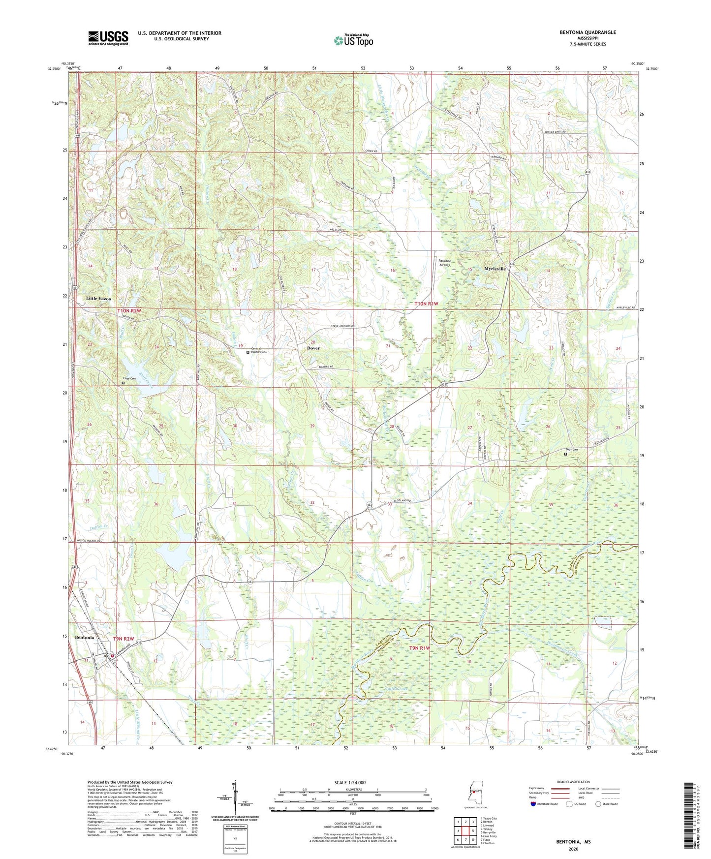
2024 topographic map quadrangle Bentonia in the state of Mississippi. Scale: 1:24000. Based on the newly updated USGS 7.5' US Topo map series, this map is in the following counties: Yazoo, Madison. The map contains contour data, water features, and other items you are used to seeing on USGS maps, but also has updated roads and other features. This is the next generation of topographic maps. Printed on high-quality waterproof paper with UV fade-resistant inks.
Quads adjacent to this one:
West: Tinsley
Northwest: Yazoo City
North: Benton
Northeast: Linwood
East: Berryville
Southeast: Charlton
South: Flora
Southwest: Coxs Ferry
This map covers the same area as the classic USGS quad with code o32090f3.
Contains the following named places: Andrew Chapel, Bentonia, Bentonia High School, Bentonia Post Office, Bentonia Town Police Department, Bentonia Volunteer Fire Department, Bentonia Watershed Structure 6 Dam, Bentonia Watershed Structure 8 Dam, Bentonia Watershed Structure 9 Dam, Big Lake Run, Cage Cemetery, Catfish Lake, Central Church, Central Holmes Cemetery, Church of God, Cypress Creek, Dalton Creek, Days Cemetery, Dover, Griffis Lake Dam, Indian Creek, Little Walesheba Creek, Little Yazoo, M S Johnson Pond Dam, Melrose Church, Myrleville, New Liberty Church, Old Liberty Church, Paradise Airport, Persimmon Creek, Pleasant Grove Church, Plumville, Rose Hill Church, Saint Paul Church, Town Creek, Town of Bentonia, W and W Gravel Company Lake Dam, Walesheba Creek, Wolf Creek, Yazoo Lookout Tower