MyTopo
Lambert Mississippi US Topo Map
Couldn't load pickup availability
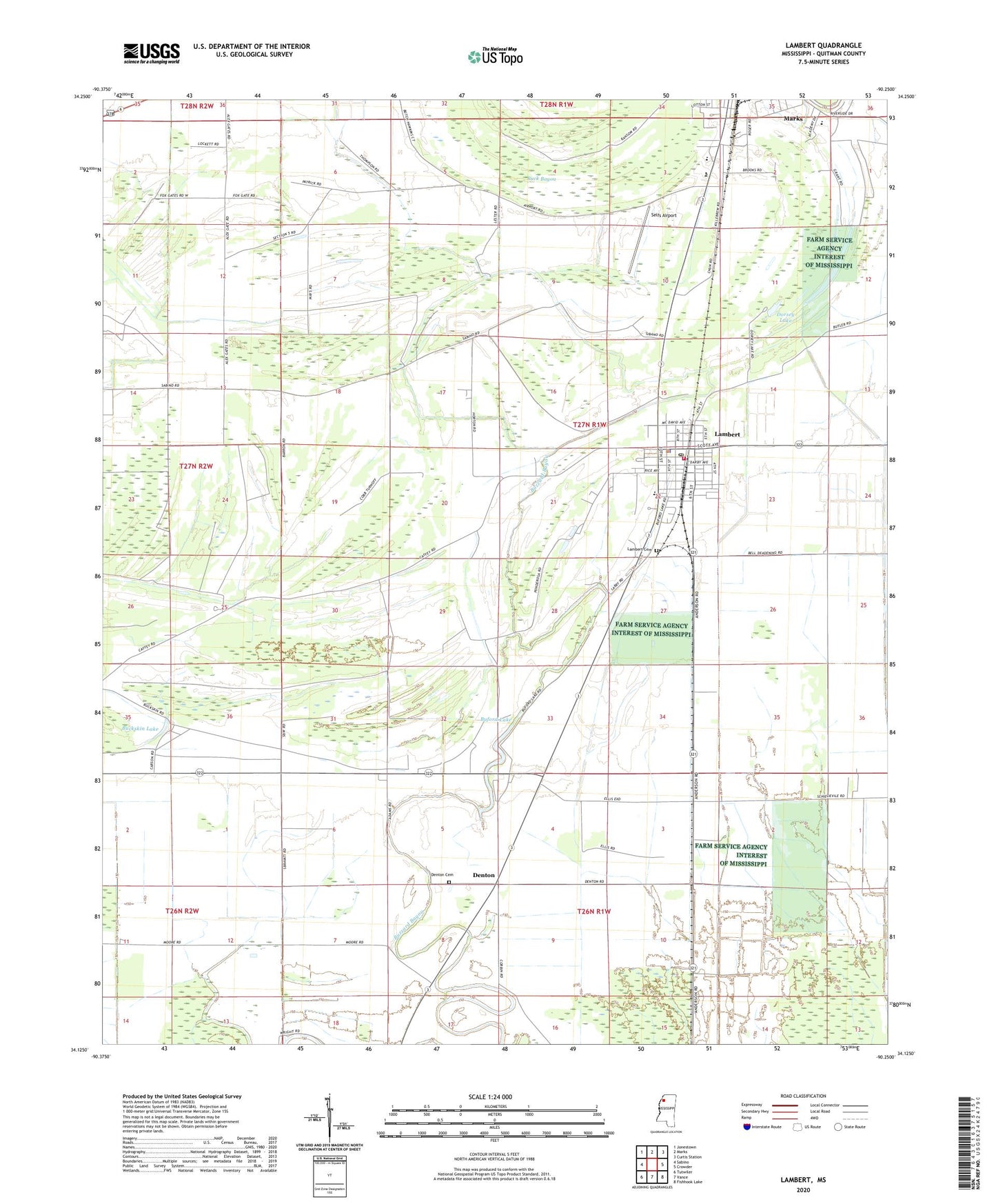
2024 topographic map quadrangle Lambert in the state of Mississippi. Scale: 1:24000. Based on the newly updated USGS 7.5' US Topo map series, this map is in the following counties: Quitman. The map contains contour data, water features, and other items you are used to seeing on USGS maps, but also has updated roads and other features. This is the next generation of topographic maps. Printed on high-quality waterproof paper with UV fade-resistant inks.
Quads adjacent to this one:
West: Sabino
Northwest: Jonestown
North: Marks
Northeast: Curtis Station
East: Crowder
Southeast: Fishhook Lake
South: Vance
Southwest: Tutwiler
This map covers the same area as the classic USGS quad with code o34090b3.
Contains the following named places: Avant School, Buck Bayou, Buckskin Lake, Buford Lake, Denton, Denton Cemetery, Dorsey Lake, First Baptist Church of Lambert, Fourmile Bayou, Greenhill Church, Hazelwood, Keefe, Lambert, Lambert Cemetery, Lambert High School, Lambert Police Department, Lambert Post Office, Lambert Volunteer Fire Department Station 1 Headquarters, Lambert Volunteer Fire Department Station 2, Mount Kingdom Church, New Mount Carmel Church, Oliverfried, Peterson Lake, Pleasant Ridge Church, Quitman County Hospital, Quitman County Industrial High School, Selfs Airport, Southside School, Supervisor District 4, Sykes Church, Tony Sabravati Lake Dam, Town of Lambert, Visitor Chapel, Woodland Chapel, Yarbrough, ZIP Code: 38643