MyTopo
Drew Mississippi US Topo Map
Couldn't load pickup availability
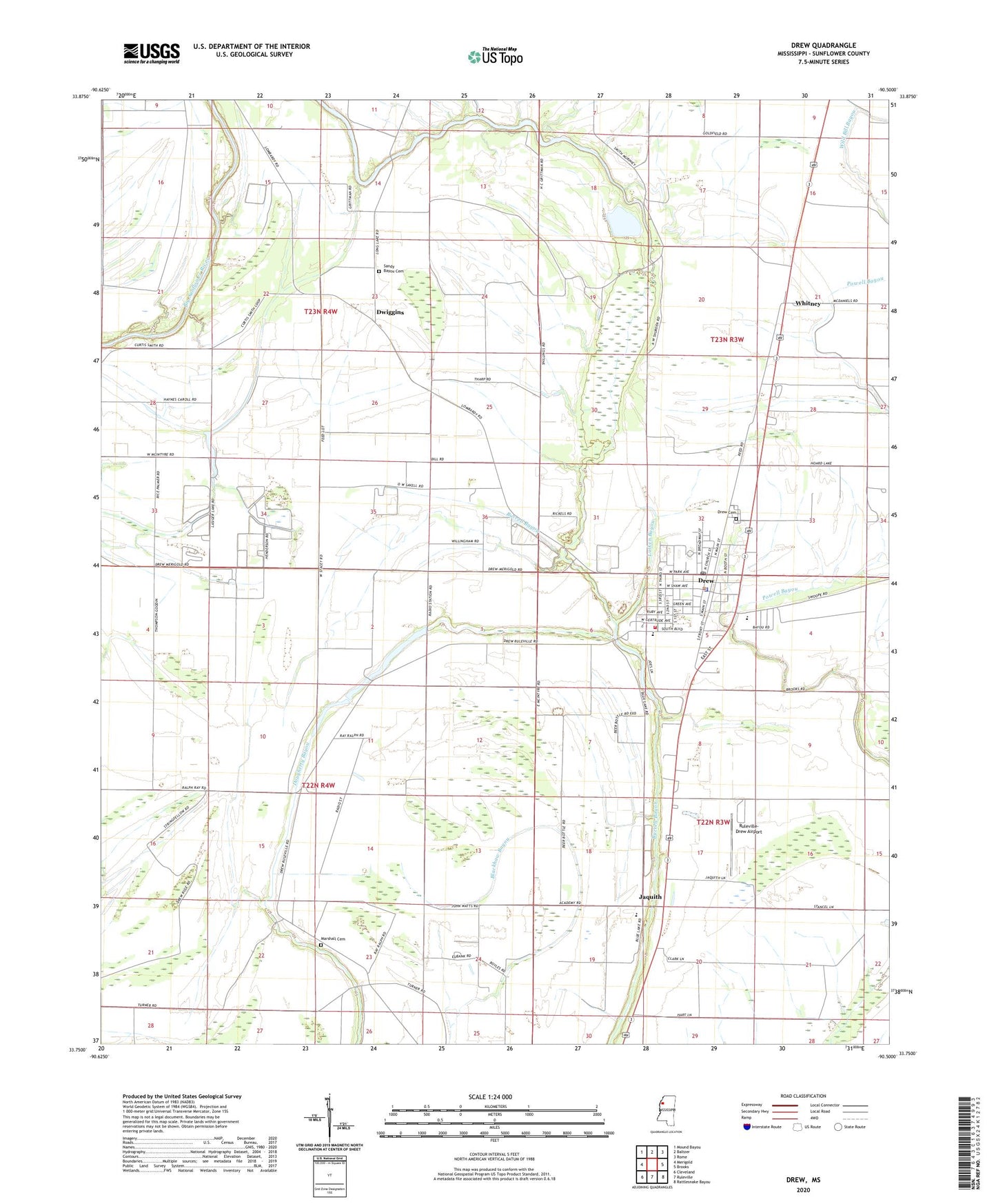
2020 topographic map quadrangle Drew in the state of Mississippi. Scale: 1:24000. Based on the newly updated USGS 7.5' US Topo map series, this map is in the following counties: Sunflower. The map contains contour data, water features, and other items you are used to seeing on USGS maps, but also has updated roads and other features. This is the next generation of topographic maps. Printed on high-quality waterproof paper with UV fade-resistant inks.
Quads adjacent to this one:
West: Merigold
Northwest: Mound Bayou
North: Baltzer
Northeast: Rome
East: Brooks
Southeast: Rattlesnake Bayou
South: Ruleville
Southwest: Cleveland
Contains the following named places: A W James Elementary School, Ballaston, Bethel Church, Blackhaw School, Blue Lake, Centerfield Church, Christian Union Church, Church of Christ, City of Drew, Drew, Drew Cemetery, Drew Health Clinic, Drew High School, Drew Lagoon Dam, Drew Police Department, Drew Post Office, Drew Public Library, Drew United Methodist Church, Drew Volunteer Fire Department, Dwiggins, First Baptist Church, Galen, Gold Dust Church, Holly Grove Baptist Church, Howard Grittman Pond Dam, Hunter High School, Jaquith, Long Lake, Long Lake School, Looney Plantation, Lusinger Lake, Lutken Bayou, Marshall Cemetery, Marshall School, Missionary Church, Mount Moriah Church, New Hope Church, New Hope School, Nora Smith Church, Pilgrim Green Church, Pilgrim Rest Church, Pleasant Grove Church, Powell Bayou, Prewitt School, Promised Land, Ruleville-Drew Airport, Saint Marys Church, Sandy Bayou, Sandy Bayou Cemetery, Stansel Plantation, Strangers Home Church, Sunflower Church, Sunflower Plantation, Supervisor District 5, Turner Chapel, Wallace Church, West Drew Church, Whitney, Whitney Church, WKZB-FM (Drew), ZIP Code: 38737