MyTopo
Eagle Bend Mississippi US Topo Map
Couldn't load pickup availability
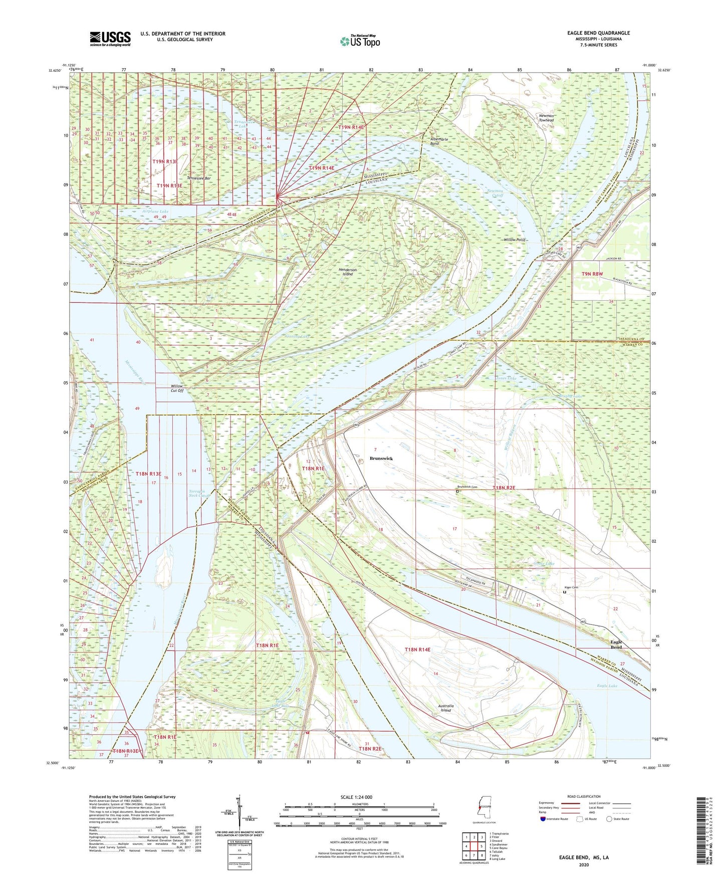
2020 topographic map quadrangle Eagle Bend in the states of Mississippi, Louisiana. Scale: 1:24000. Based on the newly updated USGS 7.5' US Topo map series, this map is in the following counties: Warren, East Carroll, Madison, Issaquena. The map contains contour data, water features, and other items you are used to seeing on USGS maps, but also has updated roads and other features. This is the next generation of topographic maps. Printed on high-quality waterproof paper with UV fade-resistant inks.
Quads adjacent to this one:
West: Sondheimer
Northwest: Transylvania
North: Fitler
Northeast: Onward
East: Cane Bayou
Southeast: Long Lake
South: Ashly
Southwest: Tallulah
Contains the following named places: Airplane Lake, Albemarle Band, Albemarle Landing, Australia Island, Bellevue Landing, Bellevule, Brunswick, Brunswick Cemetery, Brunswick Circle Levee, Brunswick Landing, Brushy Lake, Buena Vista Plantation, Chotard, Chotard Lake, Chotard Landing, Eagle Bend, Eagle Bend Census Designated Place, Eagle Lake Church, Eagle Lake Pass, Eagle Lake Volunteer Fire Department Substation, Goose Lake, Henderson, Henderson Island, Henderson Landing, Island Number One Hundred Two, Jones Lake, Kiger Cemetery, Louisiana Lake, Morning Star Church, Mount Ararat Church, Mount Olive Church, Mount Zion Church, Newman Cutoff, Newman Towhead, Peeler Landing, Salem Landing, Tennessee Bar, Tennessee Lake, Tennessee Landing, Terrapin Neck, Terrapin Neck Cutoff, Vinning Lake, Willow Cut Off, Willow Cutoff Dike, Willow Point, Willow Point Landing