MyTopo
Edinburg Mississippi US Topo Map
Couldn't load pickup availability
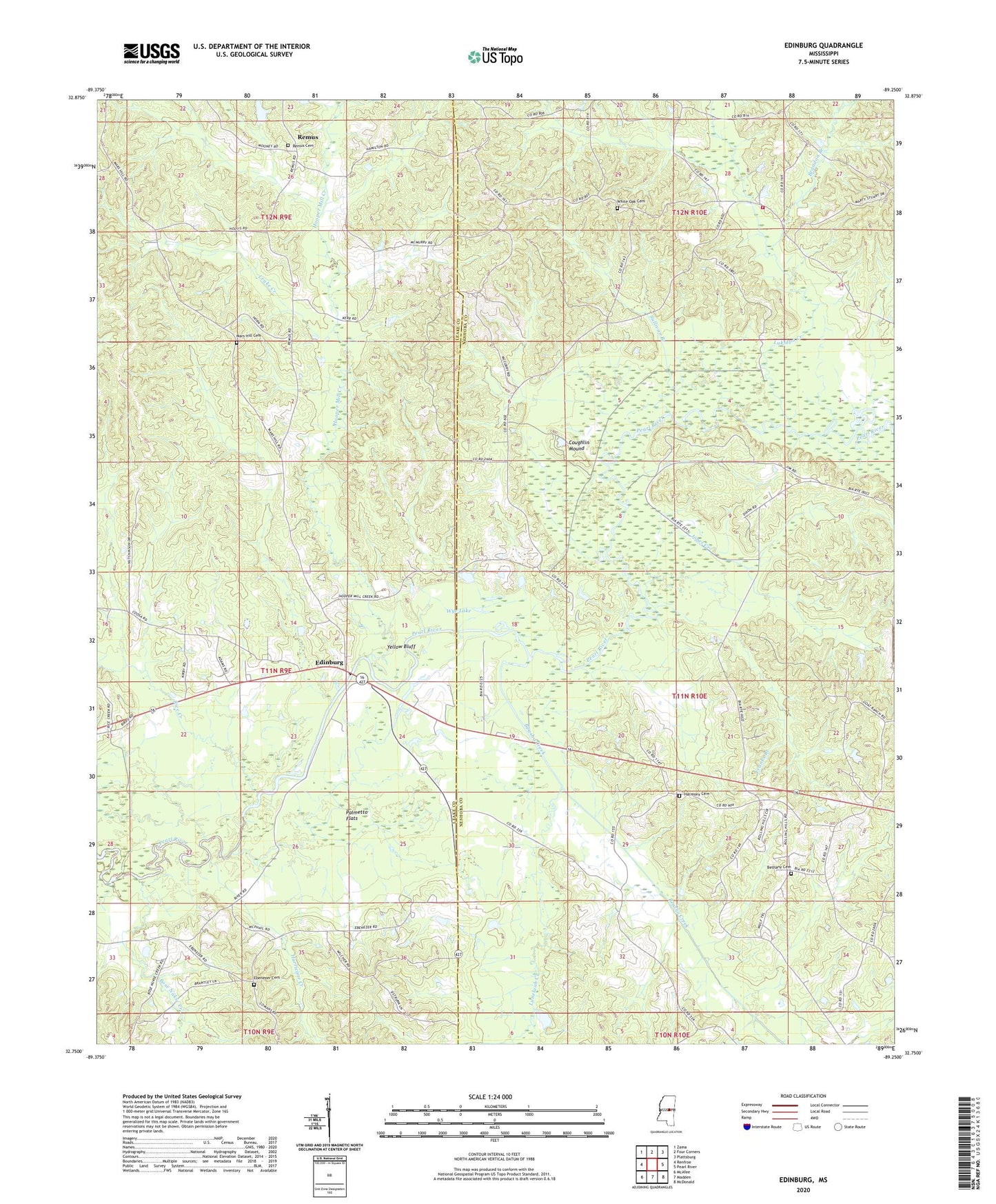
2020 topographic map quadrangle Edinburg in the state of Mississippi. Scale: 1:24000. Based on the newly updated USGS 7.5' US Topo map series, this map is in the following counties: Neshoba, Leake. The map contains contour data, water features, and other items you are used to seeing on USGS maps, but also has updated roads and other features. This is the next generation of topographic maps. Printed on high-quality waterproof paper with UV fade-resistant inks.
Quads adjacent to this one:
West: Renfroe
Northwest: Zama
North: Four Corners
Northeast: Plattsburg
East: Pearl River
Southeast: McDonald
South: Madden
Southwest: McAfee
Contains the following named places: Arlington Volunteer Fire Department Station 2, Barrett, Barrett Cemetery, Barrett Lake, Beasha Creek, Bethany Cemetery, Bose Nukse Creek, Brandon Branch, Coughlin Mound, Ebenezer, Ebenezer Cemetery, Ebenezer Church, Edinburg, Edinburg Attendance Center, Fosters, Franks Branch, Harmony Cemetery, Hill Branch, Hooper Mill Creek, Hurricane Creek, Indian Reservation Lake Dam, Jones Creek, Leake Creek, Lukfapa Creek, Luneluah Creek, Mars Hill Cemetery, Mars Hill Church, New Canaan Church, New County Line Church, New Harmony Church, New Testament Holiness Church, Norman Johnson Lake Dam, Old Canaan Church, Olney, Palmetto Flats, Pine Grove Church, Remus, Remus Cemetery, Remus Missionary Baptist Church, Remus School, Rice Creek, Sullivan Branch, Thompson Lake Dam, Underdown Lake, White Oak Cemetery, White Oak Church, Wye Lake, Yellow Bluff