MyTopo
Plattsburg Mississippi US Topo Map
Couldn't load pickup availability
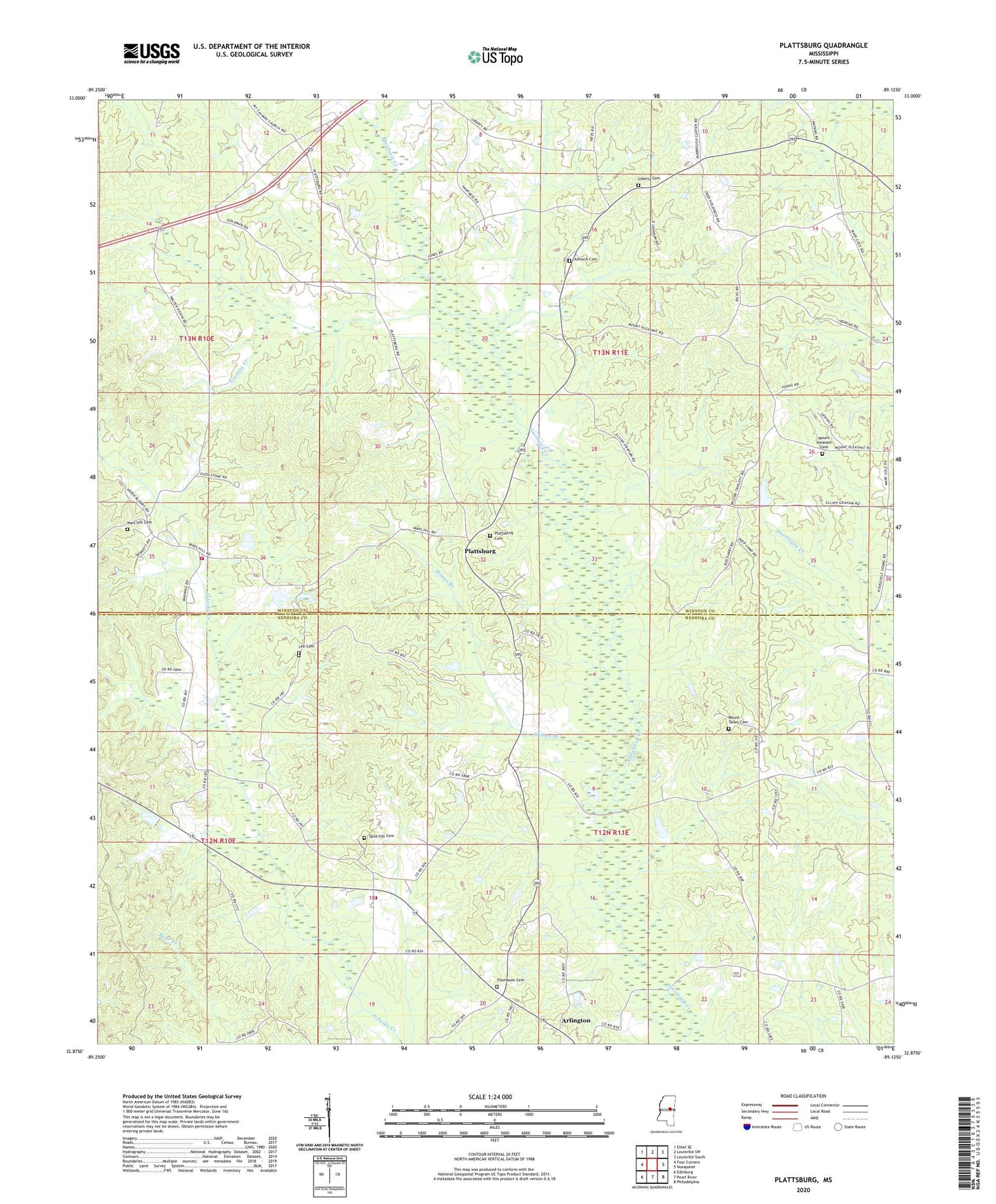
2024 topographic map quadrangle Plattsburg in the state of Mississippi. Scale: 1:24000. Based on the newly updated USGS 7.5' US Topo map series, this map is in the following counties: Winston, Neshoba. The map contains contour data, water features, and other items you are used to seeing on USGS maps, but also has updated roads and other features. This is the next generation of topographic maps. Printed on high-quality waterproof paper with UV fade-resistant inks.
Quads adjacent to this one:
West: Four Corners
Northwest: Ethel SE
North: Louisville SW
Northeast: Louisville South
East: Noxapater
Southeast: Philadelphia
South: Pearl River
Southwest: Edinburg
This map covers the same area as the classic USGS quad with code o32089h2.
Contains the following named places: Alampa Creek, Antioch Cemetery, Antioch Church, Arlington, Arlington Volunteer Fire Department Station 1 Headquarters, Deweese Lake Dam, Finis Hook, Indian Spring Church, Lee Cemetery, Liberty, Liberty Cemetery, Liberty Church, Macedonia Church, Mars Hill Cemetery, Mars Hill Church, Mars Hill Volunteer Fire Department, Mimes Branch, Mount Pleasant Cemetery, Mount Pleasant Church, Mount Talley Cemetery, Mount Talley Church, Plattsburg, Plattsburg Cemetery, Plattsburg Church, Sand Hill Cemetery, Sand Hill Church, Smallwoods School, Son Vine Lake Dam, Supervisor District 5, Thompson Cemetery, Watkins Lake Dam