MyTopo
McDonald Mississippi US Topo Map
Couldn't load pickup availability
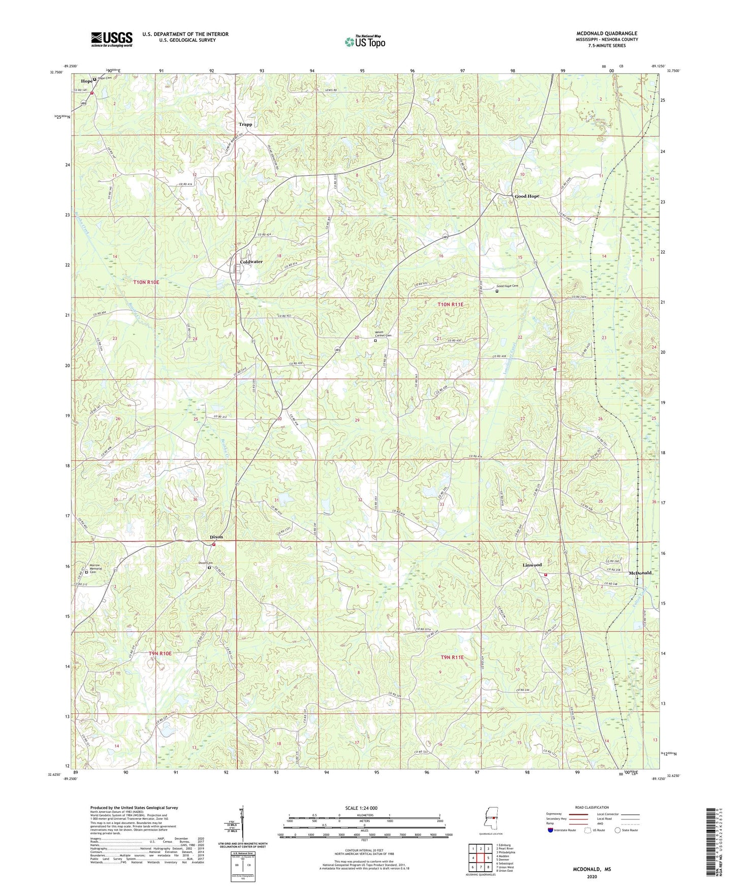
2024 topographic map quadrangle McDonald in the state of Mississippi. Scale: 1:24000. Based on the newly updated USGS 7.5' US Topo map series, this map is in the following counties: Neshoba. The map contains contour data, water features, and other items you are used to seeing on USGS maps, but also has updated roads and other features. This is the next generation of topographic maps. Printed on high-quality waterproof paper with UV fade-resistant inks.
Quads adjacent to this one:
West: Madden
Northwest: Edinburg
North: Pearl River
Northeast: Philadelphia
East: Deemer
Southeast: Union East
South: Union West
Southwest: Sebastopol
This map covers the same area as the classic USGS quad with code o32089f2.
Contains the following named places: Bill Turner Lake Dam, Bluff Springs Church, Buddy Dees Lake Dam, Coldwater, Coldwater Baptist Church, Coonshuck Creek, Deemer, Dixon, Dixon Cemetery, Dixon Volunteer Fire Department Station 1 Headquarters, E Johnson Lake Dam, Eldridge Lake Dam, Fulton Canal, Good Hope, Good Hope Baptist Church, Good Hope Cemetery, Hope, Hope Baptist Church, Hope Cemetery, Hope Volunteer Fire Department Station 1 Headquarters, Laird Lake Dam, Lenord Duncan Lake Dam, Linwood, Linwood Baptist Church, Linwood Volunteer Fire Department Station 1 Headquarters, Linwood Volunteer Fire Department Station 2, Lonsilocher Canal, McDonald, Morrow Memorial Cemetery, Mount Carmel Cemetery, Mount Carmel Church, Mount Evon Church, Neshoba County Fairgrounds, O Burrage Lake Dam, Oak Ridge Church, Pine Grove Church, Saint Paul Church, Sand Hill Church, Sapa Chitto, Scitz, Supervisor District 4, Trapp