MyTopo
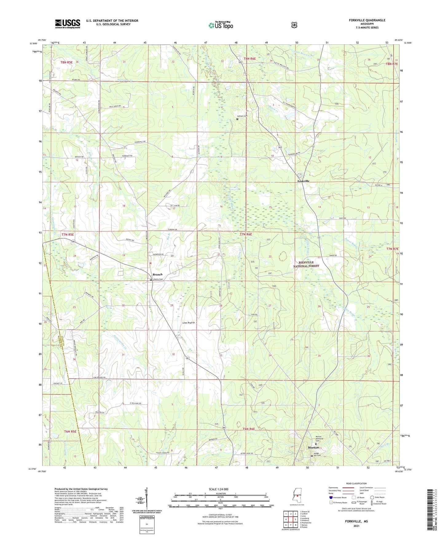
Forkville Mississippi US Topo Map
Couldn't load pickup availability
Also explore the Forkville Forest Service Topo of this same quad for updated USFS data
2024 topographic map quadrangle Forkville in the state of Mississippi. Scale: 1:24000. Based on the newly updated USGS 7.5' US Topo map series, this map is in the following counties: Scott, Rankin. The map contains contour data, water features, and other items you are used to seeing on USGS maps, but also has updated roads and other features. This is the next generation of topographic maps. Printed on high-quality waterproof paper with UV fade-resistant inks.
Quads adjacent to this one:
West: Leesburg
Northwest: Sharon SE
North: Ludlow
Northeast: Lena
East: Hillsboro
Southeast: Pulaski
South: Morton
Southwest: Pelahatchie
This map covers the same area as the classic USGS quad with code o32089d6.
Contains the following named places: Armstrong School, Bald Prairie, Balucta, Beach, Bethlehem Church, Big Branch, Branch, Branch Church, Branch School, Buck Branch, Byrns, Cherry Creek, Forkville, Groveton Church, Hodge Hill Cemetery, Howard Walker Pond Dam, Latham Cemetery, Liberty Cemetery, Line Prairie, Line Prairie Church, Line Prairie School, Macedonia Church, Morton Memorial Cemetery, New Liberty Church, Peagler Store, Pilgrim Rest Church, Pleasant Gift Church, Pleasant Grove Church, Sugar Bogue, Supervisor District 4, Truelight School