MyTopo
Leesburg Mississippi US Topo Map
Couldn't load pickup availability
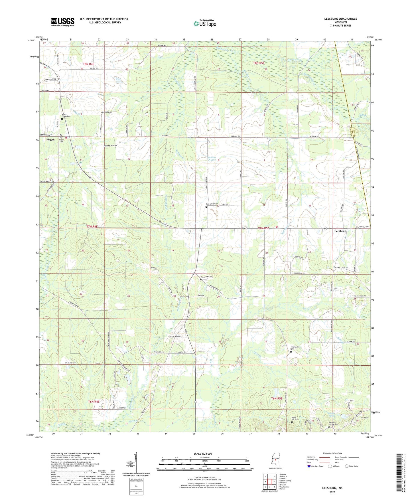
2024 topographic map quadrangle Leesburg in the state of Mississippi. Scale: 1:24000. Based on the newly updated USGS 7.5' US Topo map series, this map is in the following counties: Rankin, Scott. The map contains contour data, water features, and other items you are used to seeing on USGS maps, but also has updated roads and other features. This is the next generation of topographic maps. Printed on high-quality waterproof paper with UV fade-resistant inks.
Quads adjacent to this one:
West: Goshen Springs
Northwest: Shoccoe
North: Sharon SE
Northeast: Ludlow
East: Forkville
Southeast: Morton
South: Pelahatchie
Southwest: Brandon
This map covers the same area as the classic USGS quad with code o32089d7.
Contains the following named places: Abernathy, Barefoot School, Barefoot Spring, Barefoot Springs Cemetery, Barefoot Springs Church, Bilbros Corner, Chatman School, Church of Christ, Dry Creek, Harrell Field, Hollybush Cemetery, Hollybush Church, Hullburg Oil Field, Hurricane Creek, Lake Harbor Volunteer Fire Department Station 2, Leesburg, Leesburg Baptist Church, Leesburg Cemetery, Leesburg Prairie, Leesburg Volunteer Fire Department, Mink Branch, Mount Pisgah Cemetery, Mount Pisgah Church, Mount Pleasant Church, Neal Cemetery, New Pisgah Cemetery, Oak Grove Cemetery, Oak Grove Missionary Baptist Church, Ormand School, Outten School, Pelahatchie Cemetery, Pisgah, Pisgah High School, Pole Branch, Prairie Rest Church, Red Cane Creek, Rehobeth Cemetery, Rehobeth School, Rehoboth Church, Rollison Prairie, Round Prairie, Spring Hill Cemetery, Supervisor District 4, Ward Branch, West Leesburg