MyTopo
Goodman Mississippi US Topo Map
Couldn't load pickup availability
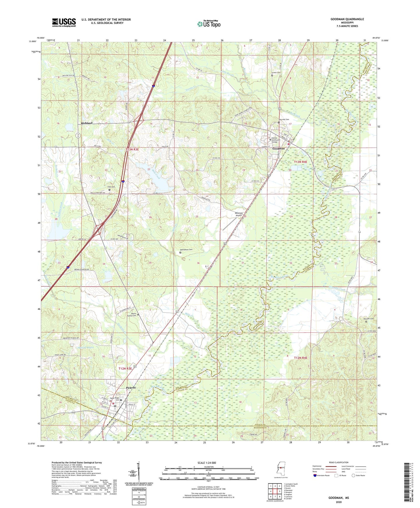
2020 topographic map quadrangle Goodman in the state of Mississippi. Scale: 1:24000. Based on the newly updated USGS 7.5' US Topo map series, this map is in the following counties: Holmes, Attala, Madison, Yazoo. The map contains contour data, water features, and other items you are used to seeing on USGS maps, but also has updated roads and other features. This is the next generation of topographic maps. Printed on high-quality waterproof paper with UV fade-resistant inks.
Quads adjacent to this one:
West: Ebenezer
Northwest: Lexington South
North: Owens Wells
Northeast: Durant
East: Newport
Southeast: Camden
South: Cameron
Southwest: Vaughan
Contains the following named places: Bethlehem Cemetery, Bethlehem Church, Box Creek, Bridgeforth Lake Dam, Falls Cemetery, Goodman, Goodman Attendance Center, Goodman Police Department, Goodman Post Office, Goodman Volunteer Fire Department, Goodman-Pickens Elementary School, Green Cemetery, Greens Creek, Hillcrest Cemetery, Holmes Junior College, Holmes Junior College Lake Dam, Little Box Creek, Mills Creek, Millsaps, Mississippi No Name 30 Dam, Mississippi No Name 34 Dam, Mitchell Cemetery, Moore Family Cemetery, Mount Moriah Church, Peterson Airport, Pickens, Pickens Attendance Center, Pickens Cemetery, Pickens Police Department, Pickens Post Office, Pickens Sewage Lagoon Dam, Pickens Volunteer Fire Department, Presleys Airport, Quiet Ridge Cemetery, Richland, Saint Marys Church, Saint Peters Church, Seneasha Creek, Spring Ridge Church, Spring Ridge School, Tackett Watershed 6 Dam, Tackett Watershed 9 Dam, Tacketts Creek, Town Creek, Town of Goodman, Town of Pickens, Union School, Valena, Williams Ferry, WVTH-FM (Goodman), ZIP Codes: 39079, 39146