MyTopo
Vaughan Mississippi US Topo Map
Couldn't load pickup availability
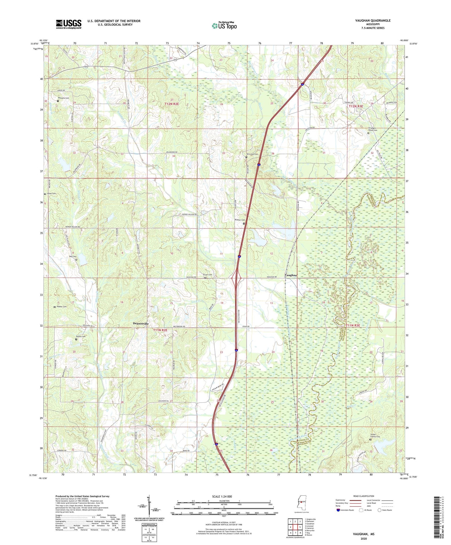
2024 topographic map quadrangle Vaughan in the state of Mississippi. Scale: 1:24000. Based on the newly updated USGS 7.5' US Topo map series, this map is in the following counties: Yazoo, Madison. The map contains contour data, water features, and other items you are used to seeing on USGS maps, but also has updated roads and other features. This is the next generation of topographic maps. Printed on high-quality waterproof paper with UV fade-resistant inks.
Quads adjacent to this one:
West: Linwood
Northwest: Zeiglerville
North: Ebenezer
Northeast: Goodman
East: Cameron
Southeast: Sharon
South: Way
Southwest: Berryville
This map covers the same area as the classic USGS quad with code o32090g1.
Contains the following named places: Alsop Cemetery, Bell Chapel, Bethel Church, Big Cypress Creek, Birds Creek, Brown Cemetery, Castens Creek, Cypress Grove Church, Day Cemetery, Deasonville, Dixon Lake Dam, Dixons Lake Dam, Dry Creek, Ellison Church, Ellison Creek Watershed Structure 3 Dam, Ellison Creek Watershed Structure 7 Dam, Exum Cemetery, Jacksons Store, Lessels Shop, Madvernize Church, Moore Lake Dam, New Zion Cemetery, New Zion Church, Peaster Cemetery, Pepper Cemetery, Pepper Lake Dam, Strangers Home Cemetery, Strangers Home Church, Thomas Lake Dam, Tucker Family Cemetery, Vaughan, Vaughan Creek, Vaughn Lake Dam, Williams Cemetery, ZIP Code: 39179