MyTopo
Ebenezer Mississippi US Topo Map
Couldn't load pickup availability
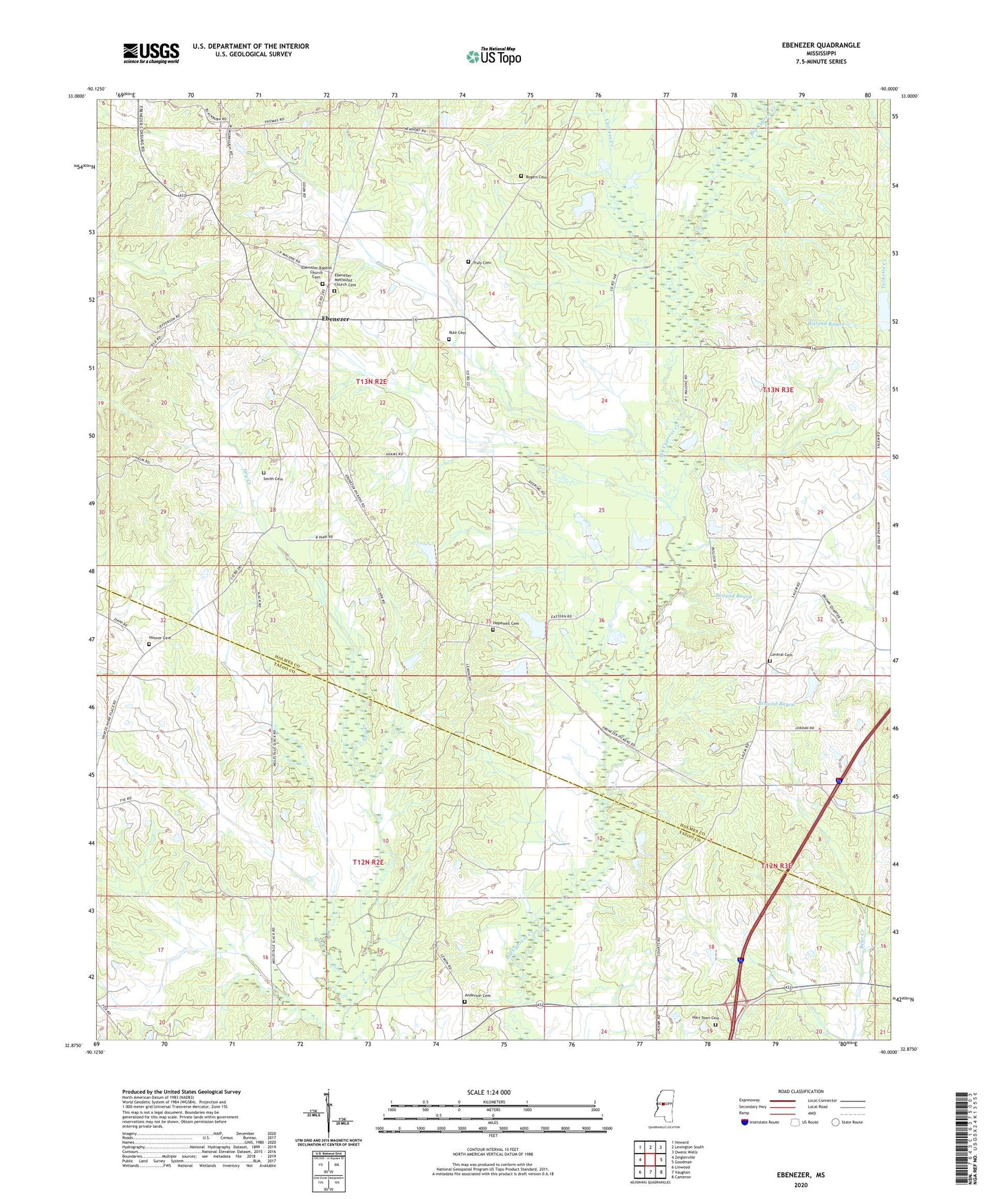
2024 topographic map quadrangle Ebenezer in the state of Mississippi. Scale: 1:24000. Based on the newly updated USGS 7.5' US Topo map series, this map is in the following counties: Holmes, Yazoo. The map contains contour data, water features, and other items you are used to seeing on USGS maps, but also has updated roads and other features. This is the next generation of topographic maps. Printed on high-quality waterproof paper with UV fade-resistant inks.
Quads adjacent to this one:
West: Zeiglerville
Northwest: Howard
North: Lexington South
Northeast: Owens Wells
East: Goodman
Southeast: Cameron
South: Vaughan
Southwest: Linwood
This map covers the same area as the classic USGS quad with code o32090h1.
Contains the following named places: Anderson Cemetery, Bisland Bayou, Bryan Swilley Pond Dam, Central Baptist Church, Central Cemetery, Christian Grove Church, Cypress Chapel, Cypress Creek, Cypress Creek Campgrounds, E F Crenshaw Junior Pond Dam, Ebenezer, Ebenezer Baptist Church, Ebenezer Baptist Church Cemetery, Ebenezer Methodist Church, Ebenezer Methodist Church Cemetery, Hart Town Cemetery, Holy City Church, Hoover Cemetery, Hopewell Cemetery, New Canaan Church, Newport Church, Pleasant Green Church, Pleasant Grove Church, Rogers Cemetery, Rule Cemetery, Saint Peters Rock Church, Salem School, Sanctified Church, Smith Cemetery, Supervisor District 3, Tackett Watershed 11 Dam, Truly Cemetery, Twin Lakes Subdivision Lake Dam, W H Austin Pond Dam, Zion City Church