MyTopo
Newport Mississippi US Topo Map
Couldn't load pickup availability
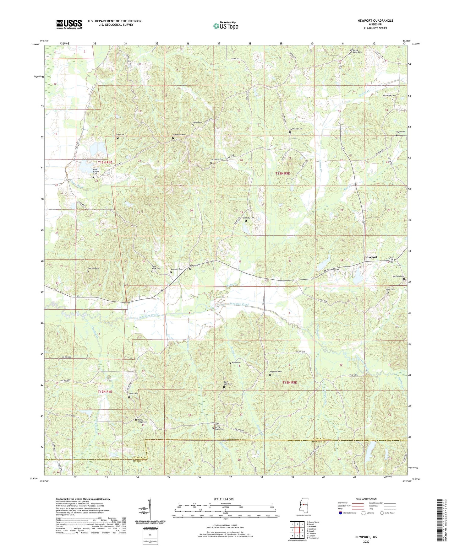
2024 topographic map quadrangle Newport in the state of Mississippi. Scale: 1:24000. Based on the newly updated USGS 7.5' US Topo map series, this map is in the following counties: Attala, Madison. The map contains contour data, water features, and other items you are used to seeing on USGS maps, but also has updated roads and other features. This is the next generation of topographic maps. Printed on high-quality waterproof paper with UV fade-resistant inks.
Quads adjacent to this one:
West: Goodman
Northwest: Owens Wells
North: Durant
Northeast: McAdams
East: Joseph
Southeast: Thomastown
South: Camden
Southwest: Cameron
This map covers the same area as the classic USGS quad with code o32089h7.
Contains the following named places: Ables Cemetery, Big Black School, Black Jack Cemetery, Bolatusha Creek, Branchville, Center Ridge Church, Crooked Creek, Deer Lake Creek, Dickerson Cemetery, Francis Lake Dam, Harmonia Cemetery, Harmonia Methodist Church, Hopewell Cemetery, Hopewell Church, Horton Creek, Lutheran Cemetery, May Creek, McClain Cemetery, McDaniel Lake Dam, Midway School, New Banyon Cemetery, New Banyon Church, New Hope, New Hope Baptist Church, New Hope Cemetery, Newport, Old Roby Cemetery, Ousley Creek, Parker Creek, Pisgah Cemetery, Pleasant Grove Cemetery, Pole Pen Cemetery, Roby Cemetery, Roby Creek, Roy Barrett Lake Dam, Saint Mark Cemetery, Saint Mark Church, Salem Cemetery West, Sallis Lookout Tower, Sandy Ridge Cemetery, Sandy Ridge Church, Seneasha Church, Seneasha Methodist Church Cemetery, Seneasha School, Shrock, Shrock Methodist Church, Shrock School, Smithson Lake Dam, Spring Grove Cemetery, Spring Grove Methodist Church, Spring Ridge Cemetery, Steward Creek, Supervisor District 4, Unger Ditch, Union Cemetery, Waugh Post Office, Wyatt Cemetery, Wyse Cemetery, ZIP Code: 39160