MyTopo
Houlka Mississippi US Topo Map
Couldn't load pickup availability
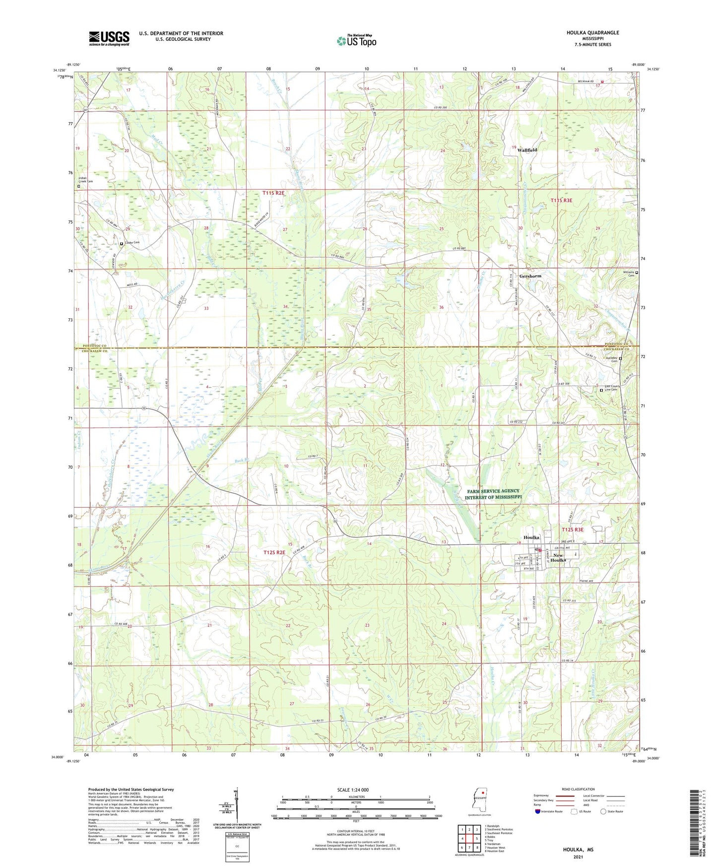
2021 topographic map quadrangle Houlka in the state of Mississippi. Scale: 1:24000. Based on the newly updated USGS 7.5' US Topo map series, this map is in the following counties: Chickasaw, Pontotoc. The map contains contour data, water features, and other items you are used to seeing on USGS maps, but also has updated roads and other features. This is the next generation of topographic maps. Printed on high-quality waterproof paper with UV fade-resistant inks.
Quads adjacent to this one:
West: Robbs
Northwest: Randolph
North: Southwest Pontotoc
Northeast: Southeast Pontotoc
East: Troy
Southeast: Houston East
South: Houston West
Southwest: Vardaman
Contains the following named places: Beckham School, Beckham Volunteer Fire Department, Brush Creek, Buck Branch, Cooke Cemetery, Cooke Memorial Church, Corper Lake Dam, East County Line Cemetery, East County Line Church, Estate Lake Dam, Gershorm, Gershorm Baptist Church, Holladay Cemetery, Houlka, Houlka Baptist Church, Houlka Church of the Nazarene, Houlka Elementary School, Houlka High School, Houlka Methodist Church, Houlka Police Department, Houlka Post Office, Houlka Presbyterian Church, Houlka Second Baptist Church, Houlka Volunteer Fire Department, Indian Creek Cemetery, Judah Church, Long Branch, Mount Prospect Church, Mount Zion Church, Mud Creek, Oak Grove, Postoak Church, Schonna Chapel, Schooner Valley Baptist Church, Schooner Valley School, Skuna River Structure Y-22-9 Dam, Town of New Houlka, Wallfield, Wallfield Church, Washington Church, West County Line Church, West Grove Church, Williams Cemetery, ZIP Code: 38850