MyTopo
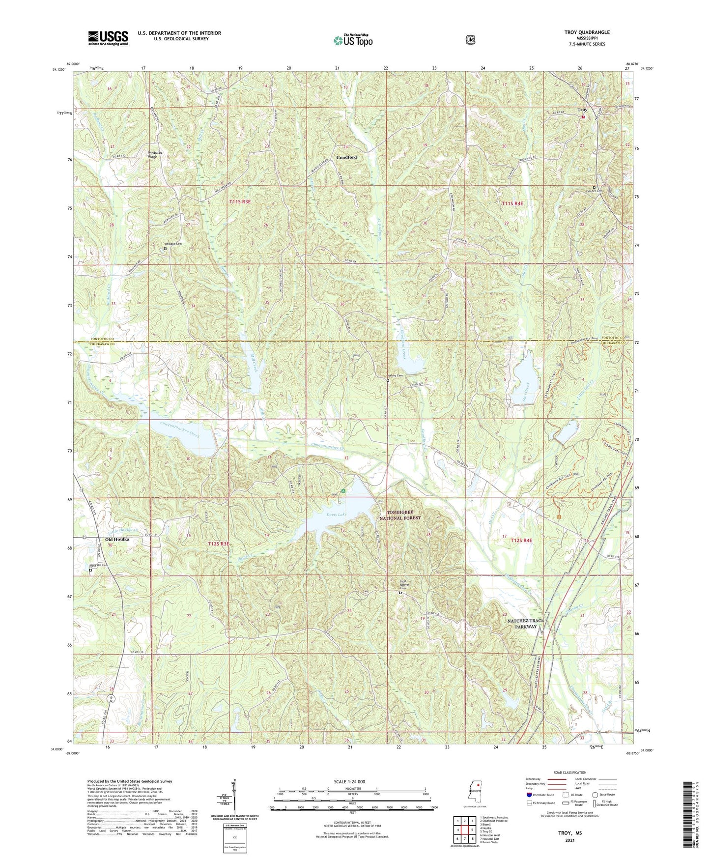
Troy Mississippi US Topo Map
Couldn't load pickup availability
Also explore the Troy Forest Service Topo of this same quad for updated USFS data
2024 topographic map quadrangle Troy in the state of Mississippi. Scale: 1:24000. Based on the newly updated USGS 7.5' US Topo map series, this map is in the following counties: Chickasaw, Pontotoc. The map contains contour data, water features, and other items you are used to seeing on USGS maps, but also has updated roads and other features. This is the next generation of topographic maps. Printed on high-quality waterproof paper with UV fade-resistant inks.
Quads adjacent to this one:
West: Houlka
Northwest: Southwest Pontotoc
North: Southeast Pontotoc
Northeast: Bissell
East: Troy SE
Southeast: Buena Vista
South: Houston East
Southwest: Houston West
This map covers the same area as the classic USGS quad with code o34088a8.
Contains the following named places: 4 A-2020 Dam, 4 A-2020 Lake, Bluff Springs Cemetery, Camp Bellewood, Center Hill Baptist Church, Chickasaw Game Management Area, Chuckafalyia, Chuquatonchee Creek Structure 1 Dam, Chuquatonchee Creek Structure 10 Dam, Chuquatonchee Creek Structure 2 Dam, Chuquatonchee Creek Structure 3 Dam, Chuquatonchee Creek Structure 4 Dam, Chuquatonchee Creek Structure 4a Dam, Chuquatonchee Creek Structure 9 Dam, Coleville, Davis Creek, Davis Lake, Davis Lake Campground, Davis Lake Dam, Falkner Cemetery, Friendship Church, Friendship School, Goodford, Goodford Creek, Halsey Cemetery, Hickory Flat, Little Creek, Little Owl Creek, Macedonia Church, Mill Creek, Monroe Missionary Station, Natchez Trace National Scenic Trail, New Salem, New Salem Church, New Salem School, Oak Grove School, Old Houlka, Owl Creek, Pilgrim Church, Primitive Baptist Church of Bethel, Red Land, Redland Cemetery, Redland Creek, Ridgeway School, Rose Hill Cemetery, Sand Branch, Sharby Creek, Shiloh Baptist Church, Shiloh School, Tockshish Mission, Toxish Church, Troy, Troy Baptist Church, Troy Woodland Volunteer Fire Department