MyTopo
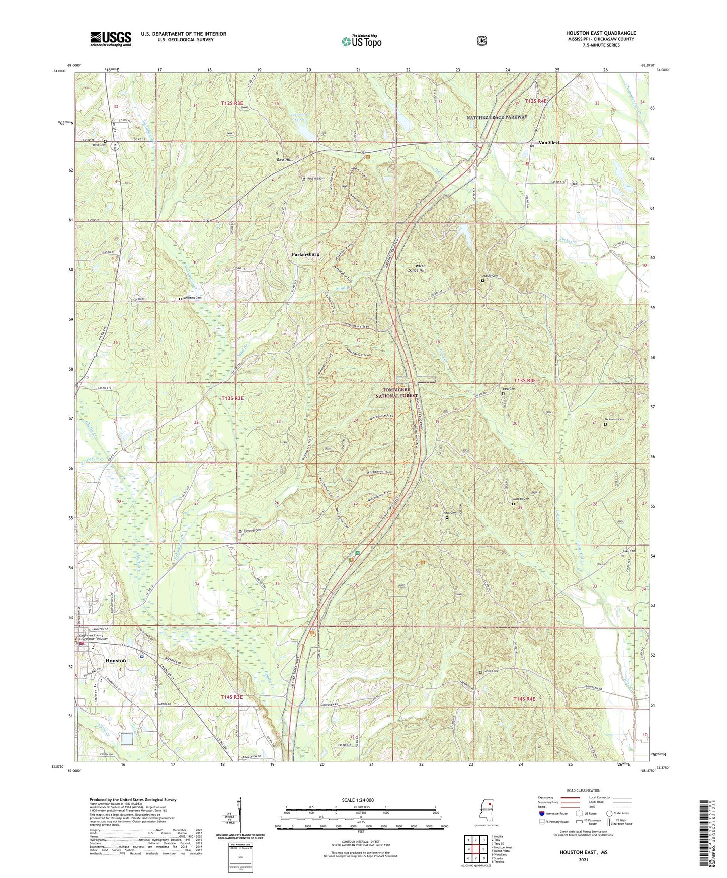
Houston East Mississippi US Topo Map
Couldn't load pickup availability
Also explore the Houston East Forest Service Topo of this same quad for updated USFS data
2024 topographic map quadrangle Houston East in the state of Mississippi. Scale: 1:24000. Based on the newly updated USGS 7.5' US Topo map series, this map is in the following counties: Chickasaw. The map contains contour data, water features, and other items you are used to seeing on USGS maps, but also has updated roads and other features. This is the next generation of topographic maps. Printed on high-quality waterproof paper with UV fade-resistant inks.
Quads adjacent to this one:
West: Houston West
Northwest: Houlka
North: Troy
Northeast: Troy SE
East: Buena Vista
Southeast: Trebloc
South: Sparta
Southwest: Woodland
This map covers the same area as the classic USGS quad with code o33088h8.
Contains the following named places: Asbury Cemetery, Asbury Church, Ashbury School, Bethlehem Missionary Baptist Church, Camp Tik-a-Witha Girl Scout Camp, Center Hill Church, Center Hill Missionary Baptist Church, Center Hill School, Chickasaw Academy, Chickasaw County, Chickasaw County Coliseum, Chickasaw County Courthouse, Chuquatonchee Creek Structure 6 Dam, Chuquatonchee Structure 7 Dam, Concord Cemetery, Concord Church, Concord School, Dam 6-2020, Fairview Church, First Assembly of God Church, Gibbs Cemetery, Houston, Houston City Hall, Houston Elementary School, Houston High School, Houston Police Department, Houston Sewage Lagoon Dam, Houston Vocational Complex, Houston Volunteer Fire Department, Joe Brigance Memorial Park, Lake Cemetery, Lake Providence Methodist Church, McKinnon Cemetery, Mississippi Normal College, Morgan Cemetery, Mount Olive Church, Neal Cemetery, Neals, New Parkersburg Baptist Church, New Salem School, New York, New Zion Church, New Zion School, Norton Springs Church, Park Lake Dam, Parkersburg, Pask Cemetery, Pettigrew Creek, Pettigrew School, Reid Cemetery, Reservoir 6-2020, Rhodes Church, Rose Hill School, Ross Hill, Ross Hill Cemetery, Ross Hill Missionary Baptist Church, Salem, Salem Church, Sand Branch, Shady Grove Church, Soctahoma Creek, Supervisor District 4, Sycamore, Thorton Hill School, Trace Regional Hospital, Trace Work Center, Van Vleet, Van Vleet Census Designated Place, Van Vleet Consolidated High School, Van Vleet Post Office, Van Vleet United Methodist Church, Van Vleet Volunteer Fire Department, Van Vlett Baptist Church, Wesley Chapel, Wesley Chapel School, Williams Cemetery, Witch Dance Hill, Witch Dance Horse Trail, Witch Dance Lookout Tower, Witch Dance Picnic Area, Zion School, ZIP Code: 38851