MyTopo
Houston West Mississippi US Topo Map
Couldn't load pickup availability
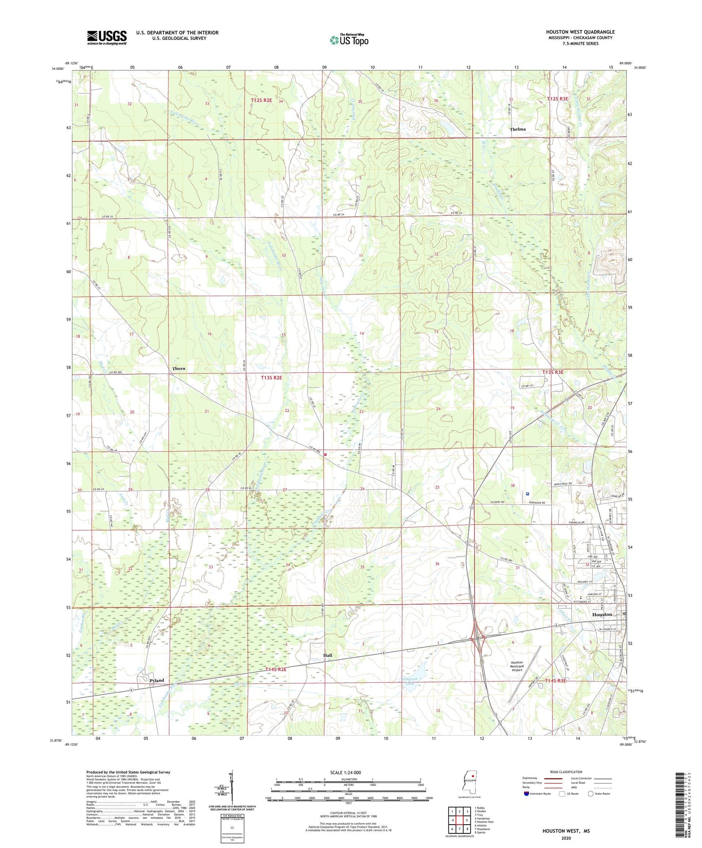
2020 topographic map quadrangle Houston West in the state of Mississippi. Scale: 1:24000. Based on the newly updated USGS 7.5' US Topo map series, this map is in the following counties: Chickasaw. The map contains contour data, water features, and other items you are used to seeing on USGS maps, but also has updated roads and other features. This is the next generation of topographic maps. Printed on high-quality waterproof paper with UV fade-resistant inks.
Quads adjacent to this one:
West: Vardaman
Northwest: Robbs
North: Houlka
Northeast: Troy
East: Houston East
Southeast: Sparta
South: Woodland
Southwest: Atlanta
Contains the following named places: Carnegie Library, Chickasaw County Regional Correctional Facility, Chickasaw County Sheriff's Office, Church of Christ, Church of our Lord, Church of the Living God, City of Houston, Fair Creek, Fair Watershed Y-24-1 Dam, Faith Bible Church, Farrs Chapel Methodist Church, First Baptist Church, First United Pentecostal Church, Fourmile Creek, Gordon Branch, Hall, Hickory Ridge School, Holladay, Houston Christian Church, Houston Church of God, Houston Church of the Nazarene, Houston Female Collegiate Institute, Houston Middle School, Houston Municipal Airport, Houston Post Office, Houston Presbyterian Church, Houston Second Missionary Baptist Church, Lick Creek, Little Houlka Creek, Martin School, New Hope Church, North Jackson Street Church of Christ, Parkway Baptist Church, Pearson Chapel, Pyland, Ridge, Simpson Lake, South Jackson Street Church of Christ, Thelma, Thorn, Thorn Church, Thorn Church of God, Thorn Volunteer Fire Department, WCPC-AM (Houston), WCPC-FM (Houston), West Creek, Westmoreland Lake Dam