MyTopo
Madden Mississippi US Topo Map
Couldn't load pickup availability
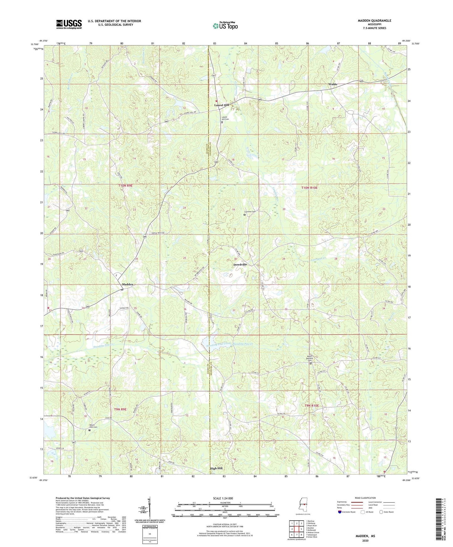
2020 topographic map quadrangle Madden in the state of Mississippi. Scale: 1:24000. Based on the newly updated USGS 7.5' US Topo map series, this map is in the following counties: Neshoba, Leake. The map contains contour data, water features, and other items you are used to seeing on USGS maps, but also has updated roads and other features. This is the next generation of topographic maps. Printed on high-quality waterproof paper with UV fade-resistant inks.
Quads adjacent to this one:
West: McAfee
Northwest: Renfroe
North: Edinburg
Northeast: Pearl River
East: McDonald
Southeast: Union West
South: Sebastopol
Southwest: Walnut Grove
Contains the following named places: Carolina Cemetery, Carolina Church, Cherry Chapel, Dixon Volunteer Fire Department Station 2, Dowdville, H Pilgrim Lake Dam, Hope Volunteer Fire Department Station 2, Laurel Hill, Laurel Hill Cemetery, Laurel Hill Church, Leake Academy, Madden, Madden Baptist Church, Madden High School, Madden Methodist Church, Madden Post Office, Madden Volunteer Fire Department, Mount Bethany Cemetery, Mount Bethany Church, Mount Zion Cemetery, Mount Zion Church, New Bethel Church, New Prospect Church, Old Arbor Mount Zion Church, Pine Grove Church, Prairie Chapel, Providence Baptist Church, W C Majors Pond Dam, Waldo, Williamsburg, Zion, Zion Church