MyTopo
Union West Mississippi US Topo Map
Couldn't load pickup availability
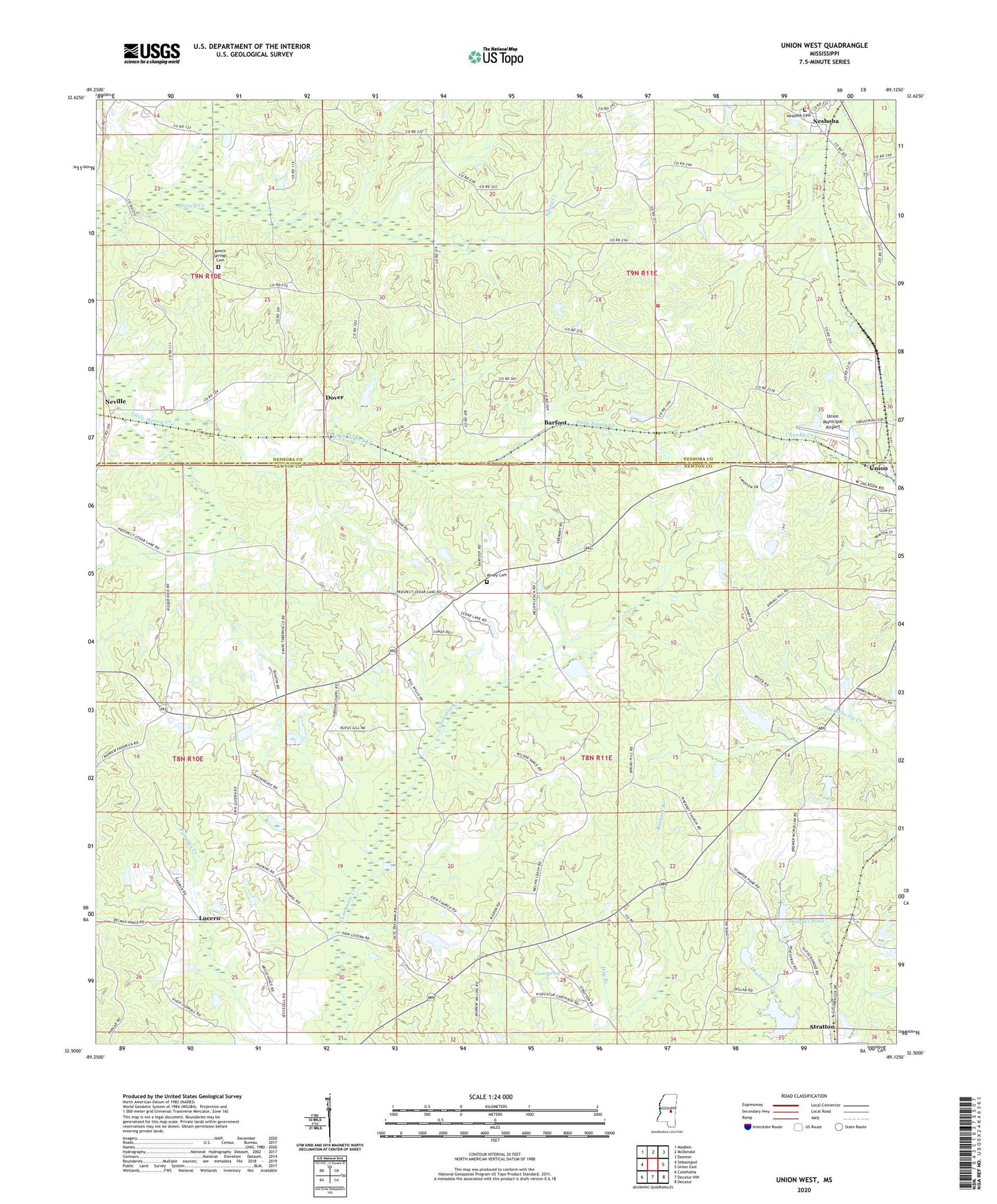
2024 topographic map quadrangle Union West in the state of Mississippi. Scale: 1:24000. Based on the newly updated USGS 7.5' US Topo map series, this map is in the following counties: Newton, Neshoba. The map contains contour data, water features, and other items you are used to seeing on USGS maps, but also has updated roads and other features. This is the next generation of topographic maps. Printed on high-quality waterproof paper with UV fade-resistant inks.
Quads adjacent to this one:
West: Sebastopol
Northwest: Madden
North: McDonald
Northeast: Deemer
East: Union East
Southeast: Decatur
South: Decatur NW
Southwest: Conehatta
This map covers the same area as the classic USGS quad with code o32089e2.
Contains the following named places: Abney Cemetery, Barfoot, Beech Springs, Beech Springs Cemetery, Bethelehem Church, Bluff Springs Church, Chanki, Chunky River Watershed 47 Dam, Doctor Laird Lake Dam, Dooley Lake Dam, Dover, Earl Laird Lake Dam, Erin Cumberland Church, Erin School, Evans Tabernacle, Fulton Creek, Greens Mill, Gum Spring, Henry Lake Dam, Hog Branch, Hudsons Chapel, Hunters Mill, Linwood Volunteer Fire Department Station 3, Little Mountain Church, Lucern, Lucern Church, Maple Springs School, Millins Mill, Mississippi No Name 228 Dam, Mount Zion Church, Neshoba, Neshoba Baptist Church, Neshoba Cemetery, Neville, New Ireland, New Ireland Church, New Island Church, Oka Kapassa, P Measells Lake Dam, Pinckney Church, Pinkney Mill, Roebuck Branch, Spring Hill Church, Stamper, Stamper Pond, T Herd Lake Dam, Union Municipal Airport, Vance Store, Walnut School, Watkins Store, Wheatfield Church, ZIP Code: 39365