MyTopo
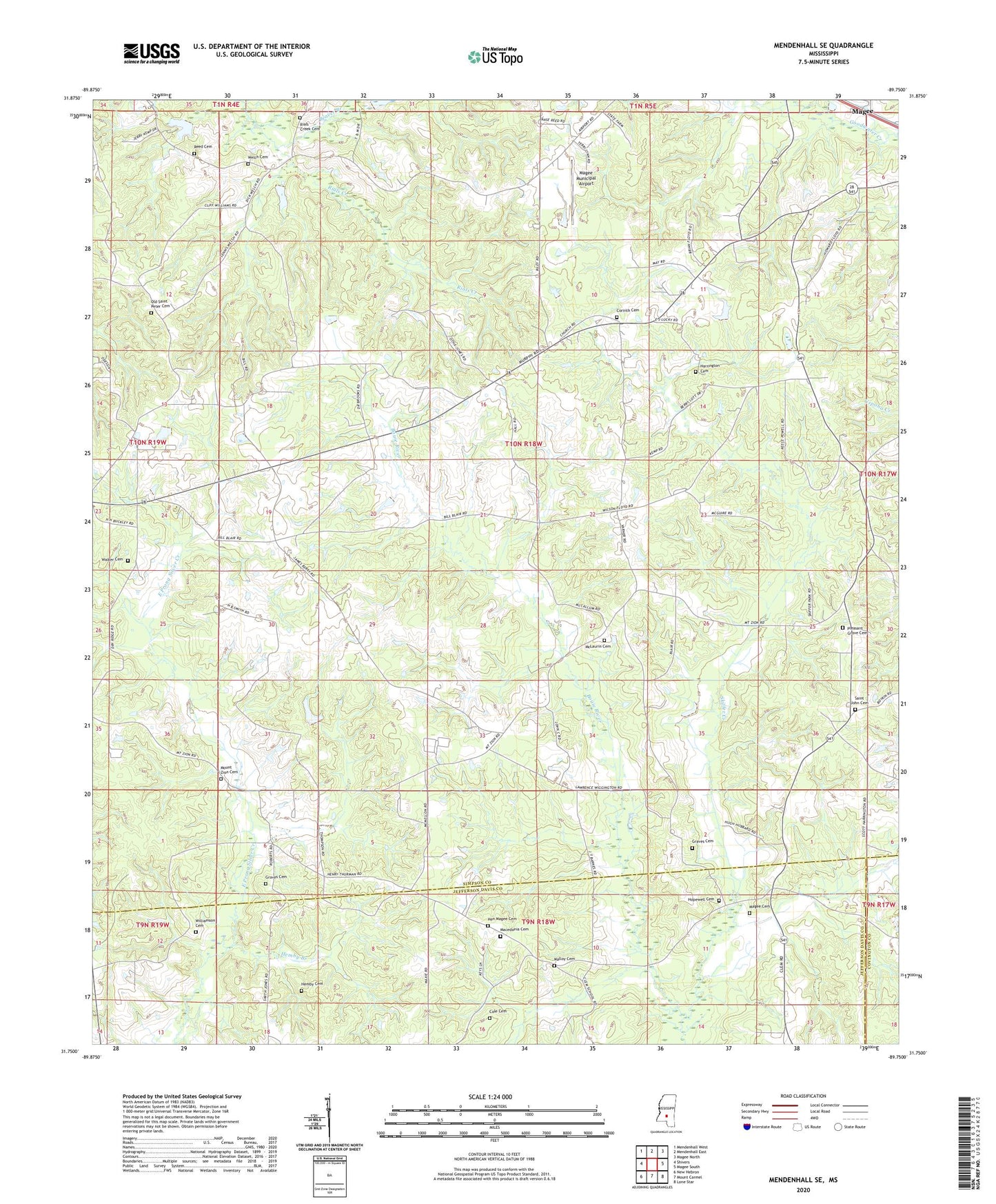
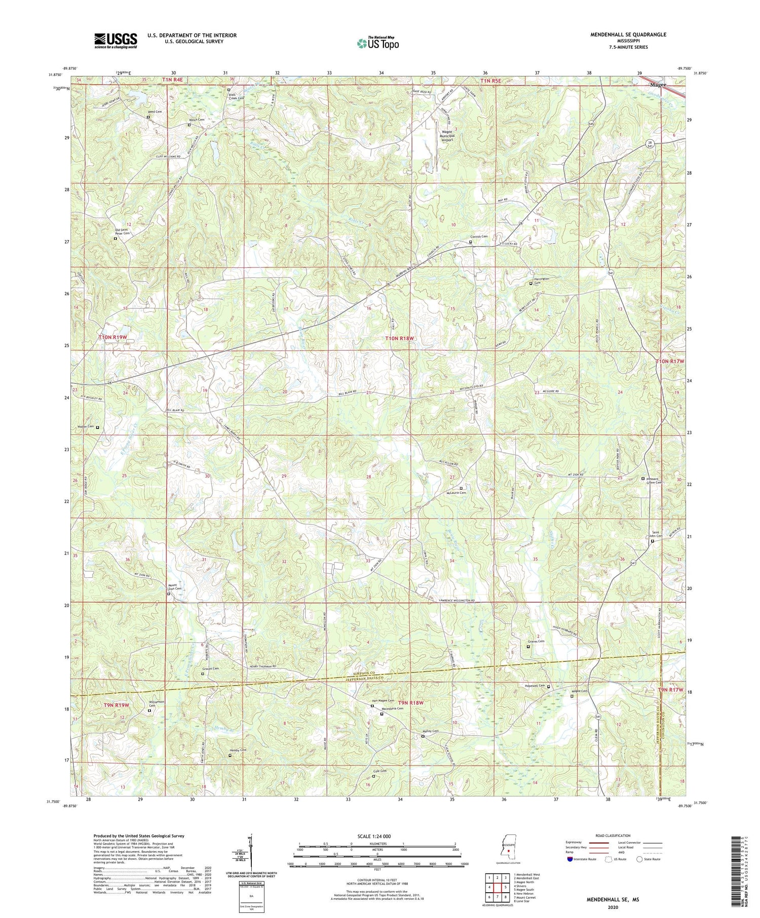
Mendenhall SE Mississippi US Topo Map
Couldn't load pickup availability
2024 topographic map quadrangle Mendenhall SE in the state of Mississippi. Scale: 1:24000. Based on the newly updated USGS 7.5' US Topo map series, this map is in the following counties: Simpson, Jefferson Davis, Covington. The map contains contour data, water features, and other items you are used to seeing on USGS maps, but also has updated roads and other features. This is the next generation of topographic maps. Printed on high-quality waterproof paper with UV fade-resistant inks.
Quads adjacent to this one:
West: Shivers
Northwest: Mendenhall West
North: Mendenhall East
Northeast: Magee North
East: Magee South
Southeast: Lone Star
South: Mount Carmel
Southwest: New Hebron
This map covers the same area as the classic USGS quad with code o31089g7.
Contains the following named places: Beaver Branch, Bowie School, Cole Cemetery, Corinth Cemetery, Corinth Church, Cyclone, Duncansville, Good Hope Church, Graves Cemetery, Harrington Cemetery, Hemby Branch, Hemby Cemetery, Hemby School, Hen Magee Cemetery, Hopewell Cemetery, Hopewell Church, Hopewell School, Jaynesville, Macedonia Cemetery, Macedonia Church, Magee Cemetery, Magee Municipal Airport, Malloy Cemetery, McLaurin Cemetery, Mount Zion, Mount Zion Baptist Church, Mount Zion Cemetery, Mount Zion School, Old Hickory, Old Saint Peter Cemetery, Pleasant Grove Cemetery, Pleasant Grove Church, Reed Cemetery, Rials Creek Cemetery, Riles Creek School, Saint John Cemetery, Saint John Church, Saint Peter Church, Skiffer Creek, Supervisor District 2, Walker Cemetery, Welch Cemetery, Williamson Cemetery