
MyTopo
Mount Carmel Mississippi US Topo Map
Couldn't load pickup availability
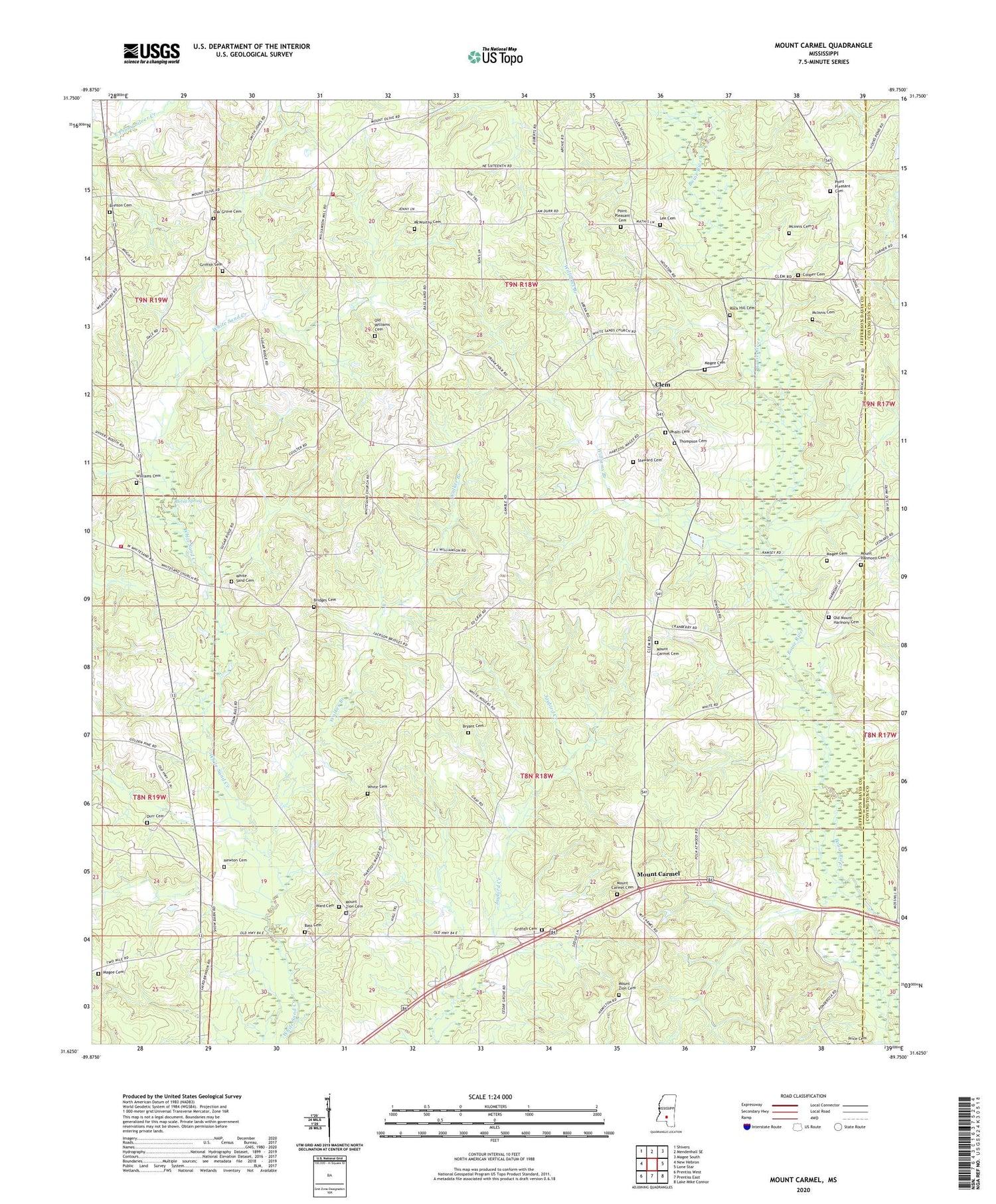
2024 topographic map quadrangle Mount Carmel in the state of Mississippi. Scale: 1:24000. Based on the newly updated USGS 7.5' US Topo map series, this map is in the following counties: Jefferson Davis, Covington. The map contains contour data, water features, and other items you are used to seeing on USGS maps, but also has updated roads and other features. This is the next generation of topographic maps. Printed on high-quality waterproof paper with UV fade-resistant inks.
Quads adjacent to this one:
West: New Hebron
Northwest: Shivers
North: Mendenhall SE
Northeast: Magee South
East: Lone Star
Southeast: Lake Mike Connor
South: Prentiss East
Southwest: Prentiss West
This map covers the same area as the classic USGS quad with code o31089f7.
Contains the following named places: Bass Cemetery, Betsy Spring, Bridges Cemetery, Brinson Cemetery, Bryant Cemetery, Clem, Clem Lookout Tower, Clem School, Cooper Cemetery, Durr Cemetery, Gray School, Griffith Cemetery, Gwinville Oil and Gas Field, Harmony Church, Jerusalem School, Lee Cemetery, Magee Cemetery, Mcinnis Cemetery, McInnis Cemetery, McWorthy Cemetery, Mount Carmel, Mount Carmel Cemetery, Mount Carmel Church, Mount Harmony Cemetery, Mount Zion Cemetery, Mount Zion Church, Newton Cemetery, Oak Grove Cemetery, Oak Grove Church, Old Mount Harmony Cemetery, Old Williams Cemetery, Phalti Cemetery, Phalti Church, Pine Bluff School, Point Pleasant Cemetery, Point Pleasant Church, Point Pleasant School, Polk School, Poplar Springs School, Prentiss Fire Department Station 2, Prentiss Fire Department Station 4, Red House School, Rock Hill Cemetery, Rock Hill Church, Steward Cemetery, Supervisor District 4, Thompson Cemetery, Walker Branch, Ward Cemetery, White Cemetery, White Sand Cemetery, Whitesand Church, Williams Branch, Williams Cemetery


