MyTopo
Merrill Mississippi US Topo Map
Couldn't load pickup availability
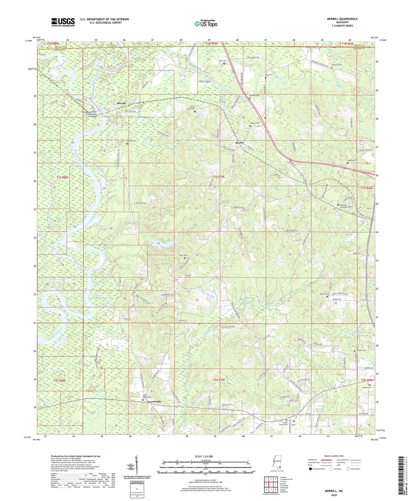
2020 topographic map quadrangle Merrill in the state of Mississippi. Scale: 1:24000. Based on the newly updated USGS 7.5' US Topo map series, this map is in the following counties: George, Greene. The map contains contour data, water features, and other items you are used to seeing on USGS maps, but also has updated roads and other features. This is the next generation of topographic maps. Printed on high-quality waterproof paper with UV fade-resistant inks.
Quads adjacent to this one:
West: Avent
Northwest: McLain
North: Leakesville SW
Northeast: Vernal
East: Lucedale
Southeast: Agricola
South: Basin
Southwest: Benndale
Contains the following named places: Ball Cemetery, Baptist Center, Bexley, Bexley Baptist Church, Bexley School, Bexley Volunteer Fire Department, Big Eddy, Booger Hole Slough, Bush Cemetery, Canaan Baptist Church, Canaan Cemetery, Central, Central Lookout, Central School, Central Volunteer Fire Department, Chickasawhay River, Cochran Dead River, Corinth Cemetery, Corinth Missionary Baptist Church, Cross Roads Cemetery, Cross Roads Methodist Church, Crossroads, Crossroads Church, Davis Eddy, Eubanks, Eubanks - Dickerson Cemetery, Eubanks Cemetery, Holmes Cemetery, Holmes Missionary Baptist Church, Howard Cemetery, Leaf River, Merrill, Merrill Boat Ramp, Merrill Cemetery, Mount Sinai Church, Pascagoula River County Road 123 Bridge, Pipkins Cemetery, Pree Creek, Pree Eddy, Round Eddy, Saint James Church, Shady Grove Baptist Church, Shady Grove Cemetery, Shady Grove Park, Smith Dead River, Straight Way Church, Supervisor District 4, Tappley Branch, Toms Creek, Woodard Cemetery