MyTopo
Vernal Mississippi US Topo Map
Couldn't load pickup availability
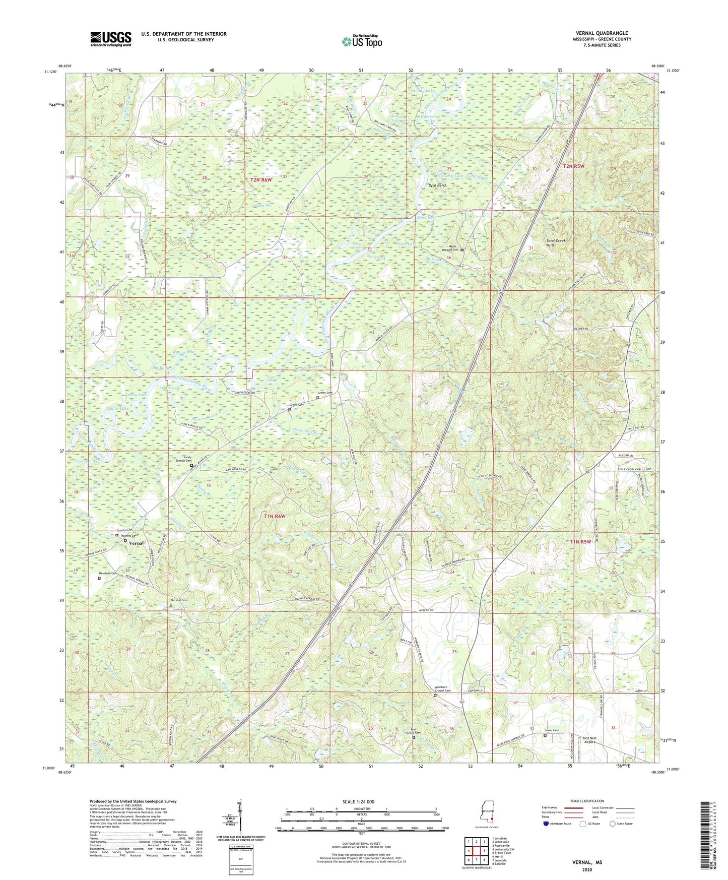
2024 topographic map quadrangle Vernal in the state of Mississippi. Scale: 1:24000. Based on the newly updated USGS 7.5' US Topo map series, this map is in the following counties: Greene. The map contains contour data, water features, and other items you are used to seeing on USGS maps, but also has updated roads and other features. This is the next generation of topographic maps. Printed on high-quality waterproof paper with UV fade-resistant inks.
Quads adjacent to this one:
West: Leakesville SW
Northwest: Jonathan
North: Leakesville
Northeast: Rounsaville
East: Brown Town
Southeast: Earlville
South: Lucedale
Southwest: Merrill
This map covers the same area as the classic USGS quad with code o31088a5.
Contains the following named places: Antioch Baptist Church, Ashley Lake, Beaver Branch, Big Eddy, Bird Nest Airport, Bobby McLeod Lake, Byrd Bend, Church of Jesus Christ, Clifton McLeod Lake, Cooley Cemetery, Cooley Lake, Crawford Creek, Crawford Lake, Curry Lake, Dickerson Branch, Dove Branch, Fence Lake, Fishhook Branch, Foshee Eddy, Gin Creek, Green Cemetery, Green Eddy, Guy Dickerson Lake, Highland Farms, Horseshoe Lake, James Dickerson Lake Dam, Juniper Bay, Kennard Lake, Lewis Cemetery, Log Lake, Long Branch, Maple - McLeod Cemetery, Maples Creek, McInnis Cemetery, McIntosh Cemetery, McLeod Cemetery, McLeod Creek, Midway Church, Mineral Branch, Muddy Lake, Pine Grove Cemetery, Roads Creek, Sand Creek Hills, Sand Hill Church, Sand Lake, Sandy Branch, Sandy Branch Cemetery, Sandy Creek, Supervisor District 4, Taylor Lake, Vernal, Vernal Church, Wenny Lake, White Chapel, White Lake, Wilson Creek, Windburn Chapel Cemetery, Windburn Church, Wooton Creek